IMAGES TAKEN NEAR TO
The Quadrangle, WORTHING, BN14 0RB
Introduction
This page details the photographs taken nearby to The Quadrangle, BN14 0RB by members of the Geograph project.
The Geograph project started in 2005 with the aim of publishing, organising and preserving representative images for every square kilometre of Great Britain, Ireland and the Isle of Man.

There are currently over 7.5m images from over14,400 individuals and you can help contribute to the project by visiting https://www.geograph.org.uk
Image Map
Images are licensed for reuse under creativecommons.org/licenses/by-sa/2.0
Notes
- Clicking on the map will re-center to the selected point.
- The higher the marker number, the further away the image location is from the centre of the postcode.
Image Listing (51 Images Found)
Images are licensed for reuse under creativecommons.org/licenses/by-sa/2.0
Image
Details
Distance
1
The Quadrangle
A cul de sac off Findon Road, the A24, which was built towards the end of the 1930s over a former field called The Munns, according to Findon's 1839 tithe map.
Image: © Simon Carey
Taken: 2 Jun 2013
0.03 miles
2
Findon Telephone Exchange
Located at the southern end of the village on Findon Road.
Image: © Simon Carey
Taken: 13 Jul 2013
0.04 miles
4
Southways School, Vale House
A mixed independent special school for those aged 7 to 17. Prior to that Vale House was part of another set of racing stables that operated here from the late 19th century to 1988, the last occupant emigrating to Hong Kong to train there. Parts of the former stables lie to the rear of the house and have been converted into classrooms.
Image: © Simon Carey
Taken: 26 Jul 2013
0.07 miles
6
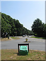
Findon Road
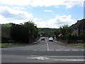
The point where the Findon Bypass on the right rejoins its old course at the junction with Cross Lane and Nepcote and heads south to Worthing.
Image: © Simon Carey
Taken: 13 Jul 2013
0.07 miles
7
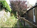
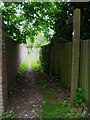
Footpath between The Vale and houses on The Quadrangle
Image: © Dave Spicer
Taken: 27 Sep 2009
0.08 miles
8
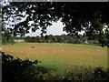
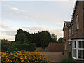
West Common Field
The name of the field according to Findon's 1839 tithe map viewed from the footpath that links Roger's Lane to Findon Road. The houses in the distance on the right are part of Image
Image: © Simon Carey
Taken: 13 Jul 2013
0.08 miles
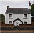
9
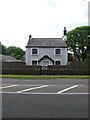
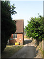
Vale Cottage, Findon Road
A 19th century whitewashed flint built cottage on the main A24 at the southern end of the village near to the border with Worthing.
Image: © Simon Carey
Taken: 2 Jun 2013
0.09 miles
10
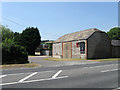
The Vale Craft Studios, Findon Road
An old flint barn now used as a business premises which once belonged to neighbouring Image Beyond is The Vale once a riding school and now split between a school and residential use.
Image: © Simon Carey
Taken: 13 Jul 2013
0.09 miles