
IMAGES TAKEN NEAR TO
Dyke Road, BRIGHTON, BN1 3JB
Introduction
This page details the photographs taken nearby to Dyke Road, BN1 3JB by members of the Geograph project.
The Geograph project started in 2005 with the aim of publishing, organising and preserving representative images for every square kilometre of Great Britain, Ireland and the Isle of Man.

There are currently over 7.5m images from over14,400 individuals and you can help contribute to the project by visiting https://www.geograph.org.uk
Image Map
Images are licensed for reuse under creativecommons.org/licenses/by-sa/2.0
Notes
- Clicking on the map will re-center to the selected point.
- The higher the marker number, the further away the image location is from the centre of the postcode.
Image Listing (806 Images Found)
Images are licensed for reuse under creativecommons.org/licenses/by-sa/2.0
Image
Details
Distance
1
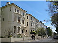
Dyke Road, BN1 (3)
South of Albert Road.
Image: © Mike Quinn
Taken: 16 May 2012
0.02 miles
2

Albert Road
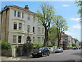
Head north along Alexandra Villas then at the junction with Albert Road turn east. Still on the land of the original workhouse and like Alexandra Villas and Leopold Road constructed as high quality middle class residences from the 1870s onwards. Many are now subdivided into flats.
Click on the link to take you to the next page. http://www.geograph.org.uk/photo/212413
Image: © Simon Carey
Taken: 30 Jul 2006
0.03 miles


6
Dyke Road
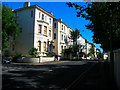
Head west back down Westhill Road and then turn south down Dyke Road. At this point the road climbs to the peak of the hill before descending into Brighton town centre. The villas were constructed in the 1870s on the site of the original workhouse that was constructed in 1820 and moved in 1870 to Race Hill where the buildings are used by Brighton General Hospital today.
Click on the link to take you to the next page. http://www.geograph.org.uk/photo/212390
Image: © Simon Carey
Taken: 30 Jul 2006
0.04 miles
7
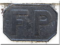
FP, Dyke Road, BN1
I think that this is an old plaque indicating that there is a fire point (ie a source of water for fighting fires) nearby. There is a similar plaque in Church Street Image
Image: © Mike Quinn
Taken: 16 May 2012
0.04 miles
10
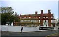
Royal Alexandra Quarter, Dyke Road, Brighton
The former Royal Alexandra Hospital has now been converted into flats. The original hospital opened in 1868 but moved to this purpose built site in 1881 where it remained until moved again to a new modern building to the rear of the Royal Sussex County Hospital. There were fears the building would be demolished, however, the main building has been retained and converted into flats. The extensions the hospital acquired over the years have gone with new flats built to replace them.
Image: © Simon Carey
Taken: 1 Nov 2015
0.05 miles