1
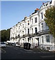
Belvedere Terrace, Brighton
Located on the south eastern side of Norfolk Road and built in the late 1840s.
Image: © Simon Carey
Taken: 25 Oct 2015
0.01 miles
2
Car park, Montpelier Place Baptist Chapel, Hove
Image: © nick macneill
Taken: 9 Mar 2012
0.02 miles
3
A chippy that may have had a former life as a bank
Traditional Fish & Chips the sign says - like it's traditional for a chippy to have once been a bank!
Image: © Slbs
Taken: 13 May 2009
0.02 miles
4
Montpelier Inn, Montpelier Place
The building dates from around 1849 and is on the corner of Borough Street.
Image: © Simon Carey
Taken: 11 Jan 2009
0.03 miles
5
St Stephens church, Montpelier Place, Brighton
Opened in 1852 having been moved and rebuilt brick by brick from its original site adjacent to the Royal Pavilion where it had been the Chapel Royal which itself had taken over the former ballroom of the Castle Inn. The church eventually closed in 1939 wherepon it became the Diocese of Chichester's Institute for the Deaf and Dumb. They moved to Carlton Hill in 19974 and since 1988 the building has been used as a First Base homeless shelter.
Image: © Simon Carey
Taken: 25 Oct 2015
0.03 miles
6
Montpelier Place Baptist Church, Hove
Image: © nick macneill
Taken: 9 Mar 2012
0.03 miles
7
Abbey Hotel, Norfolk Terrace
Continue along Montpelier Terrace then turn north into Norfolk Terrace. Another terrace built in the 1830s for the ever expanding town. The Abbey Hotel had a reputation for seediness often letting rooms to those hovering about homelessness. Now it is just a cheap hotel on the edge of the town centre.
Click on the link to take you to the next page. http://www.geograph.org.uk/photo/211794
Image: © Simon Carey
Taken: 30 Jul 2006
0.04 miles
8
Old Boundary Marker by Boundary Passage, Montpelier Place, Brighton
Parish Boundary Marker by the UC road, in parish of Brighton (Brighton and Hove District), Boundary Passage, at junction with Montpelier Place.
Surveyed
Milestone Society National ID: SX_BNHV02pb
Image: © Milestone Society
Taken: Unknown
0.04 miles
9
Former Church, Montpelier Terrace
Continue up Temple Street then turn west into Montpelier Terrace. You will then pass what was once St Stephens church. This was opened in 1851 with an interior reconstructed from the Royal Chapel of the Pavilion. It remained a church until 1939 before becoming home to the Sussex Diocese Association of the Deaf and Dumb. Since 1974 it has been a day centre for the homeless run by Free Base.
Click on the link to take you to the next page. http://www.geograph.org.uk/photo/211792
Image: © Simon Carey
Taken: 30 Jul 2006
0.04 miles
10
Montpelier Place Baptist Church, Brighton
This church's flock is very largely pigeons on the roof, but just one particular part of the roof.
Image: © Robin Webster
Taken: 30 Apr 2010
0.04 miles


