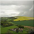
IMAGES TAKEN NEAR TO
Patching, WORTHING, BN13 3XW

Introduction

This page details the photographs taken nearby to BN13 3XW by members of the Geograph project.

The Geograph project started in 2005 with the aim of publishing, organising and preserving representative images for every square kilometre of Great Britain, Ireland and the Isle of Man.

There are currently over 7.5m images from over14,400 individuals and you can help contribute to the project by visiting https://www.geograph.org.uk

Image Map


Images are licensed for reuse under creativecommons.org/licenses/by-sa/2.0
Notes
  • Clicking on the map will re-center to the selected point.
  • The higher the marker number, the further away the image location is from the centre of the postcode.

Image Listing (31 Images Found)

Images are licensed for reuse under creativecommons.org/licenses/by-sa/2.0
  • ...
Image
Details
Distance
1
Lower Barpham
Former farm that is all that remains of the former village of Barpham whose earthworks can still be viewed in the field to the immediate right, see Image Beyond is Harrow Hill
Image: © Simon Carey Taken: 27 Aug 2013
0.00 miles
2
Lower Barpham on the South Downs
Looking down to Lower Barpham a favourite view in Sussex.
Image: © Chris Thomas-Atkin Taken: 24 Dec 2020
0.00 miles
3
Lower Barpham
The farm is all that remains of a former village that was located in the field to the west of it, see Image for a view of the field. Harrow Hill is in the centre whilst Blackpatch Hill is in the distance to the right.
Image: © Simon Carey Taken: 30 May 2009
0.01 miles
4
Lower Barpham
Looking down and across the grid to Lower Barpham farm. Probably one of the best views on the South Downs.
Image: © Chris Thomas-Atkin Taken: 24 Sep 2018
0.01 miles
5
Lower Barpham
A view of the farmhouse located in the south east corner of Image To the left is Blackpatch Hill whilst beyond in the distance is Church Hill which lies above the village of Findon.
Image: © Simon Carey Taken: 1 Aug 2013
0.01 miles
6
Lower Barpham
This was taken from the bridleway to Michelgrove Park.
Image: © Shazz Taken: 6 Dec 2011
0.01 miles
7
Lower Barpham Farm
Looking NE.
Image: © Janine Forbes Taken: 19 Nov 2005
0.01 miles
8
View NE towards Lower Barpham and Harrow Hill
This is a cross-grid shot. The camera was in TQ0609.
Image: © Ian Hawfinch Taken: 22 May 2021
0.02 miles
9
A glimpse of Lower Barpham
The Lower Barpham farm can just be seen through a small gap in the trees.
Image: © Chris Thomas-Atkin Taken: 24 Sep 2018
0.02 miles
10
Lower Barpham
Looking towards Lower Barpham with Barpham Hill in the background.
Image: © Chris Thomas-Atkin Taken: 1 Oct 2018
0.02 miles
  • ...