IMAGES TAKEN NEAR TO
Michelgrove, WORTHING, BN13 3XQ

Introduction

This page details the photographs taken nearby to Michelgrove, BN13 3XQ by members of the Geograph project.

The Geograph project started in 2005 with the aim of publishing, organising and preserving representative images for every square kilometre of Great Britain, Ireland and the Isle of Man.

There are currently over 7.5m images from over14,400 individuals and you can help contribute to the project by visiting https://www.geograph.org.uk

Image Map


Images are licensed for reuse under creativecommons.org/licenses/by-sa/2.0
Notes
  • Clicking on the map will re-center to the selected point.
  • The higher the marker number, the further away the image location is from the centre of the postcode.

Image Listing (48 Images Found)

Images are licensed for reuse under creativecommons.org/licenses/by-sa/2.0
  • ...
Image
Details
Distance
1
Fire-damaged house at Michelgrove
Image: © Ian Hawfinch Taken: 13 May 2021
0.01 miles
2
Security gate at Michelgrove
Sited where the public road ends and the Angmering Park Estate begins.
Image: © Dave Spicer Taken: 25 Jun 2011
0.01 miles
3
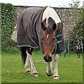
Horse near Michelgrove
Image: © Ian Hawfinch Taken: 14 May 2021
0.01 miles
4
Michelgrove
Looking down Michelgrove Lane towards the gate that marks the end of the public highway known and the start of the access road to Lee Farm which is a public bridleway. For many centuries Michelgrove was the site of a large house belonging to the Shelley family and its home farm. In 1800 the Shelleys sold out to Liverpool merchant Richard Walker and he and particularly his son extended the house and had grandiose plans to landscape the surrounding parkland. However, the son, Richard Watt Walker, squandered his inheritance and was forced to sell the house in 1827 to his neighbour, the Duke of Norfolk, The farm had already moved in 1814 to its current site at Myrtle Grove whilst the house was demolished in 1828 by the Duke who had no need of it, prefering to amalgamate Michelgrove Park with his estate. The grounds were later used as racing stables and a smaller house and a row of cottages were built on the site of the old mansion, of which only one wall and a walled garden remain.
Image: © Simon Carey Taken: 5 Sep 2013
0.03 miles
5
Walled paddock and gate at Michelgrove
Image: © Shazz Taken: 24 Jul 2011
0.03 miles
6
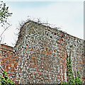
Old wall near Michelgrove
This photo shows a small part of a large walled enclosure.
Image: © Ian Hawfinch Taken: 14 May 2021
0.03 miles
7
Remains of walled garden at Michelgrove
Image: © Dave Spicer Taken: 20 Dec 2009
0.05 miles
8
Approaching Michelgrove
Heading south on the bridleway towards Michelgrove where there are the Grade II listed remains of Michelgrove House. The house was one of the largest and most famous houses in Sussex.
Image: © Chris Thomas-Atkin Taken: 1 Oct 2018
0.06 miles
9
Road through Michelgrove
The remains of Michelgrove's walled garden can be seen to the left of the road.
Image: © Slbs Taken: 25 Jun 2008
0.06 miles
10
Michelgrove
Small hamlet featuring a large house and a few cottages and bungalows. Once the seat of a great house owned by the Shelley family which included a large area of parkland now part of the Angmering Park Estate. The great house was sold by the Shelleys to a Richard Walker in 1800 whose dissolute sons ran up so much debt they were forced to sell in 1828 to the Duke of Norfolk who combined the Michelgrove lands with his own to make up the current large estate that stretches from Warningcamp in the west to Salvington in the east. The house was demolished in 1877 and little remains today. The public lane ends at the gate where it becomes a private access road for Lee Farm.
Image: © Simon Carey Taken: 30 May 2009
0.06 miles
  • ...