IMAGES TAKEN NEAR TO
The Street, WORTHING, BN13 3UY
Introduction
This page details the photographs taken nearby to The Street, BN13 3UY by members of the Geograph project.
The Geograph project started in 2005 with the aim of publishing, organising and preserving representative images for every square kilometre of Great Britain, Ireland and the Isle of Man.

There are currently over 7.5m images from over14,400 individuals and you can help contribute to the project by visiting https://www.geograph.org.uk
Image Map (Loading...)


Getting Data...Please wait
Leaflet Map data © OpenStreetMap
Images are licensed for reuse under creativecommons.org/licenses/by-sa/2.0
Notes
- Clicking on the map will re-center to the selected point.
- The higher the marker number, the further away the image location is from the centre of the postcode.
Image Listing (27 Images Found)
Images are licensed for reuse under creativecommons.org/licenses/by-sa/2.0
Image
Details
Distance
1
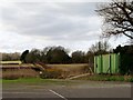
Ploughed field, Patching
Looking towards the village of Clapham.
Image: © nick macneill
Taken: 15 Feb 2013
0.08 miles
2
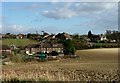
Clapham village viewed from the SE corner of Patching village
Image: © Dave Spicer
Taken: 20 Dec 2009
0.10 miles
3
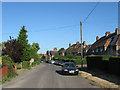
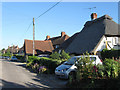
The Street
Looking westwards down the village street of Clapham. The cottages on the right were built as council houses in the 1920s.
Image: © Simon Carey
Taken: 20 Jul 2013
0.12 miles
4
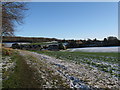
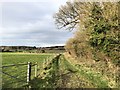
Farmers Mead
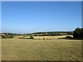
The name of the field according to Clapham's 1843 tithe map viewed from the lane to the church. The land drops down into a dry valley containing Longfurlong, the A280, before rising again and heading towards the neighbouring village of Patching whose church spire can just be seen in the distance.
Image: © Simon Carey
Taken: 20 Jul 2013
0.14 miles
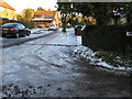
6
Clapham Close
Small cul de sac off The Street that was built sometime in the 1960s.
Image: © Simon Carey
Taken: 20 Jul 2013
0.15 miles
7
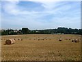
Clapham Field
The name of the field according to Patching's 1847 tithe map that is located to the south of Coldharbour Lane, west of Longfurlong and north of Image and Image
Image: © Simon Carey
Taken: 28 Aug 2017
0.17 miles
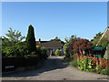
8
Little Thatch, The Street
A 17th century thatched cottage on the main village street.
Image: © Simon Carey
Taken: 20 Jul 2013
0.17 miles
9
Track beside Church Copse
Close to the village of Clapham with a distant view of Patching.
Image: © Chris Thomas-Atkin
Taken: 11 Feb 2019
0.18 miles