IMAGES TAKEN NEAR TO
Regency Road, BRIGHTON, BN1 2RU
Introduction
This page details the photographs taken nearby to Regency Road, BN1 2RU by members of the Geograph project.
The Geograph project started in 2005 with the aim of publishing, organising and preserving representative images for every square kilometre of Great Britain, Ireland and the Isle of Man.

There are currently over 7.5m images from over14,400 individuals and you can help contribute to the project by visiting https://www.geograph.org.uk
Image Map
Images are licensed for reuse under creativecommons.org/licenses/by-sa/2.0
Notes
- Clicking on the map will re-center to the selected point.
- The higher the marker number, the further away the image location is from the centre of the postcode.
Image Listing (1381 Images Found)
Images are licensed for reuse under creativecommons.org/licenses/by-sa/2.0
Image
Details
Distance
1

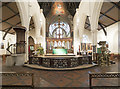
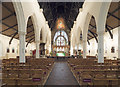
St Paul's Church
St Paul's Church, West Street, Brighton
Image: © Stan Wray
Taken: 17 Sep 2008
0.01 miles
2
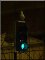
Brighton: traffic light in West Street
Like most street furniture in Brighton, this traffic light doubles up as a perch for a seagull.
Image: © Chris Downer
Taken: 20 Jun 2011
0.02 miles
4
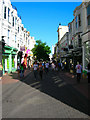
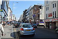
Duke Street
Head east down Cranbourne Street to West Street then a little south before you reach Duke Street. This is part of old Brighton originally called Craggs Lane. The area was built from the late 18th/early 19th century onwards though some of the side was redeveloped in 1867. The street has long been a shopping street particularly boutiques and other more specialist outlets and was pedestrianised in 1984.
Click on the link to take you to the next page. http://www.geograph.org.uk/photo/212527
Image: © Simon Carey
Taken: 30 Jul 2006
0.02 miles
5
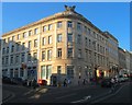
Phoenix House, West Street, Brighton
Built in the mid 1930s as part of the West Street road widening scheme and also included the building of a new road, Regency Road, which linked West Street to Upper Russell Street. See http://regencysociety-jamesgray.com/volume7/source/jg_7_095.html for the old buildings prior to demolition.
Image: © Simon Carey
Taken: 11 Oct 2015
0.02 miles
6

West Street, Brighton
The A2010 heading south to the seafront. Usually full of traffic but empty on the morning of Christmas Day. The street marks the western end of the old town area and was once much narrower. All buildings on the western side of the street were removed during the 1920s and 30s for widening.
Image: © Simon Carey
Taken: 25 Dec 2019
0.02 miles
7

St Paul's Church (spire), Brighton
Saint Paul's was opened on October 18th 1848, was consecrated a year later, and is Grade II listed building.
Image: © Roger D Kidd
Taken: 1 Jan 2013
0.02 miles
8
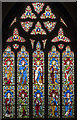
St Paul, Brighton - Stained glass window
Image: © John Salmon
Taken: 8 Jul 2017
0.02 miles