
IMAGES TAKEN NEAR TO
Norfolk Place, BRIGHTON, BN1 2PF
Introduction
This page details the photographs taken nearby to Norfolk Place, BN1 2PF by members of the Geograph project.
The Geograph project started in 2005 with the aim of publishing, organising and preserving representative images for every square kilometre of Great Britain, Ireland and the Isle of Man.

There are currently over 7.5m images from over14,400 individuals and you can help contribute to the project by visiting https://www.geograph.org.uk
Image Map
Images are licensed for reuse under creativecommons.org/licenses/by-sa/2.0
Notes
- Clicking on the map will re-center to the selected point.
- The higher the marker number, the further away the image location is from the centre of the postcode.
Image Listing (621 Images Found)
Images are licensed for reuse under creativecommons.org/licenses/by-sa/2.0
Image
Details
Distance
1
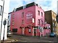
Robin Hood Pub
The pub is known as a people's pub with its profits being distributed to local community organisations http://www.peoplespubs.com/
Image: © Paul Gillett
Taken: 17 Dec 2011
0.01 miles
2
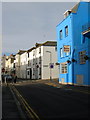
Robin Hood, Norfolk Place
The pub has had a makeover recently changing colour from a garish pink to this now bright blue. It is located on the old boundary between Brighton and Hove with Cross Street beyond in the latter.
Image: © Simon Carey
Taken: 25 Jan 2014
0.01 miles
3
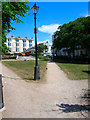
Norfolk Square
Head eastwards from Boundary Passage's southern entrance and you come to Norfolk Square constructed in the 1820s on the site of an old brickfield called Blacklands. This small square is bounded on its northern side by Western Road, the main shopping street that runs from Churchill Square, Brighton to Palmeira Square in Hove. The square itself has a reputation for seediness being a popular hangout for drunks and vagrants.
Click link to go the next page. http://www.geograph.org.uk/photo/211443
Image: © Simon Carey
Taken: 30 Jul 2006
0.01 miles
4
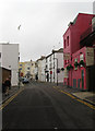
Norfolk Place
Small side street that links Norfolk Square to Little Western Street. The pub is the Robin Hood a local community run hostelry that donates any profits after running costs have been deducted to local charities. Beyond the junction with Little Western Street , which marks the boundary between Brighton and Hove, is Image
Image: © Simon Carey
Taken: 30 Oct 2011
0.01 miles
5
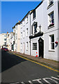
Cross Street
Taken from the former boundary of Brighton and Hove looking into the latter.
Image: © Simon Carey
Taken: 2 Apr 2007
0.02 miles
6
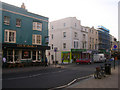
Duke of Norfolk, Western Road
The pub is in this square as is half of Little Western Street next to it, the La Palma Cafe is actually in TQ2904. The cafe was originally a cinema opening in 1912 and was known as the Embassy from 1948 until its closure in 1981. The auditorium was finally removed in 2007 becoming flats whilst the frontage has become a cafe.
Image: © Simon Carey
Taken: 21 Nov 2008
0.02 miles
7
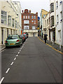
Little Western Street
Looking up to the junction with Western Road. The street marks the old boundary between Brighton and Hove with the houses on the left in the latter and those to the right in the former.
Image: © Simon Carey
Taken: 30 Oct 2011
0.02 miles
8
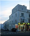
1, Western Road, Hove
Located on the corner of Little Western Street is the former Embassy Cinema. The building had originally been the Little Western Arms public house that was built in 1835. It later became a club and tea rooms and was converted into a cinema in 1912 being known as Hove Cinematograph (1911-22), Tivoli (1922-48) and Embassy (1948-81). It was never a major cinema and often showed re-runs of slightly older films no longer shown by the major chains. After its closure in 1981 it was converted into a bingo hall in 1980s and became Laser Warriors adventure game centre in the 1990s. It remained derelict until around 2006 when the former foyer was converted into a cafe. The following year the auditorium was demolished and replaced by housing visible to the left.
Old images
Embassy, 1981 - http://www.photosbrightonandhove.org.uk/timeline/1980s/embassy-cinema.html
Amusement arcade/Laser Warriors, 1990s - http://www.brightonfilm.com/cinemas/pics/embassy1.gif
Image: © Simon Carey
Taken: 21 Nov 2015
0.02 miles
9
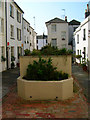
Farman Street
A small courtyard with entrances from Cross Street and Western Road via a covered passageway. The construction in the centre is for bins with small cottages to the west and three storey buildings to the right.
Image: © Simon Carey
Taken: 2 Apr 2007
0.02 miles
10
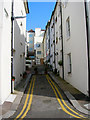
Farman Street
This is the view from Cross Street with the passageway to Western Road centre left.
Image: © Simon Carey
Taken: 2 Apr 2007
0.02 miles