1
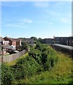
Ferring Rife
Rife is a local Sussex word for a small river found largely on the coastal plain between Worthing and Chichester. Ferring Rife rises in Durrington then heads westwards across the Goring Gap through north Ferring before heading south on the western side of the village. Here it passes between Goring Chase to the right and Lavant Close to the left.
Image: © Simon Carey
Taken: 13 Aug 2017
0.03 miles
2
View of Durrington-on-Sea area
Taken from Highdown Hotel just below the viewpoint parking area, this view covers the area of Durrington on Sea in this grid square, with Goring-by-Sea in the distance. The picture was taken looking directly southeast, diagonally across the square.
Image: © Pam Brophy
Taken: 15 Apr 2005
0.06 miles
3
Roundabout on Littlehampton Road with pedestrian bridge
Image: © Shazz
Taken: 3 Oct 2015
0.08 miles
4
May Bridge, Goring Street, Goring
Taking the A259 over Ferring Rife. The flats on the right are part of Goring Chase whilst in the distance is
Image
Image: © Simon Carey
Taken: 13 Aug 2017
0.08 miles
5
Goring Crossways
An old crossroads now a major road junction on the western side of the Worthing conurbation. To the south is Goring Street, the A259, to the west is Littlehampton Road, the A259, to the north Titnore Lane, a minor road that may become an A road in the future, and to the east is also Littlehampton Road, here the A2032.
Image: © Simon Carey
Taken: 13 Aug 2017
0.09 miles
6
Goring-by-Sea, Ferring Rife
Ditch draining into the Channel at Ferring, between fields and power lines.
Image: © Mike Faherty
Taken: 23 Feb 2019
0.10 miles
7
Littlehampton Road, Goring
A view of the eastbound A2032 from the footbridge near Goring Crossways.
Image: © Simon Carey
Taken: 13 Aug 2017
0.11 miles
8
Learning Resource Centre, Northbrook College, Littlehampton Road, Goring
A fairly recent edition to the college's West Durrington campus.
Image: © Simon Carey
Taken: 13 Aug 2017
0.11 miles
9
Goring-by-Sea, path
Footpath and cycle route next to Goring Street, heading towards Goring Crossway.
Image: © Mike Faherty
Taken: 23 Feb 2019
0.16 miles
10
The Eight Acres/Barn Field/Lower West Field
The name of the fields according to Goring's 1839 tithe map that have been combined along with
Image,
Image and
Image to the west to form one large field between Goring to the east, Ferring to the west, Ferring Rife to the north and the railway line to the south. The Eight Acres was in the foreground part of which was lost to the construction of the railway in 1846, Lower West Field was to the north adjacent to Ferring Rife whilst Barn Field was situated somewhere between the two. Highdown Hill provides the backdrop.
Image: © Simon Carey
Taken: 13 Aug 2017
0.17 miles


