
IMAGES TAKEN NEAR TO
Telgarth Road, WORTHING, BN12 5PX
Introduction
This page details the photographs taken nearby to Telgarth Road, BN12 5PX by members of the Geograph project.
The Geograph project started in 2005 with the aim of publishing, organising and preserving representative images for every square kilometre of Great Britain, Ireland and the Isle of Man.

There are currently over 7.5m images from over14,400 individuals and you can help contribute to the project by visiting https://www.geograph.org.uk
Image Map
Images are licensed for reuse under creativecommons.org/licenses/by-sa/2.0
Notes
- Clicking on the map will re-center to the selected point.
- The higher the marker number, the further away the image location is from the centre of the postcode.
Image Listing (38 Images Found)
Images are licensed for reuse under creativecommons.org/licenses/by-sa/2.0
Image
Details
Distance
1
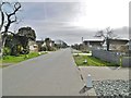
Ferring, Ocean Drive
A wide, house and bungalow-lined road from Ferringham Lane towards the coast.
Image: © Mike Faherty
Taken: 9 Mar 2019
0.11 miles
2
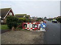
Beehive Lane, BN12 5NL
Road works at junction with Chalet Road.
Image: © Peter Holmes
Taken: 11 Feb 2017
0.12 miles
3
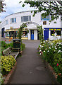
Ocean Parade
Small parade of shops in the southern part of Ferring at the point where Ferringham Lane joins Ocean Drive.
Image: © Simon Carey
Taken: 20 Jul 2008
0.13 miles
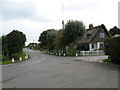
5

Close up, Elizabeth II postbox on Florida Road, Ferring
Postbox No. BN12 1801.
Image: © JThomas
Taken: 1 Apr 2025
0.14 miles
6
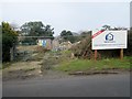
Site of The Beehive, Beehive Lane, BN12 5NL
Until recently there was an interesting thatched cottage on this site, sadly now demolished. Despite opposition from local residents Arun District Council have granted planning permission for construction of a block of 8 flats on the site.
Image: © Peter Holmes
Taken: 11 Feb 2017
0.15 miles
7
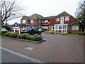
Cornwell House, Beehive Lane, BN12 5NN
Residential Care Home administered by Abbeyfield Ferring Society.
Image: © Peter Holmes
Taken: 11 Feb 2017
0.15 miles
8

Elizabeth II postbox on Florida Road, Ferring
Postbox No. BN12 1801.
Image: © JThomas
Taken: 1 Apr 2025
0.15 miles
9
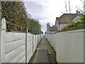
Ferring, footpath
From the end of Ocean Drive to the coastal path and beach.
Image: © Mike Faherty
Taken: 9 Mar 2019
0.16 miles
10
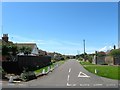
Somerset Road, Ferring
A residential road that links Sea Lane to Jersey Road that was built in the 1950s. Once a field called Great Man's Field according to Ferring's 1837 tithe map.
Image: © Simon Carey
Taken: 6 Aug 2017
0.16 miles