IMAGES TAKEN NEAR TO
Beehive Close, WORTHING, BN12 5NS
Introduction
This page details the photographs taken nearby to Beehive Close, BN12 5NS by members of the Geograph project.
The Geograph project started in 2005 with the aim of publishing, organising and preserving representative images for every square kilometre of Great Britain, Ireland and the Isle of Man.

There are currently over 7.5m images from over14,400 individuals and you can help contribute to the project by visiting https://www.geograph.org.uk
Image Map
Images are licensed for reuse under creativecommons.org/licenses/by-sa/2.0
Notes
- Clicking on the map will re-center to the selected point.
- The higher the marker number, the further away the image location is from the centre of the postcode.
Image Listing (30 Images Found)
Images are licensed for reuse under creativecommons.org/licenses/by-sa/2.0
Image
Details
Distance
1
Tamarisk Way, Ferring
A cul de sac off Sea Lane developed in the 1950s.
Image: © Simon Carey
Taken: 6 Aug 2017
0.03 miles
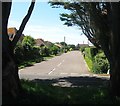
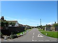
3
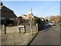
Beehive Close BN12 5NS
At junction with Beehive Lane.
Image: © Peter Holmes
Taken: 11 Feb 2017
0.04 miles
5
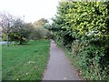
Footpath adjacent to Sea Lane
Public footpath 3092.
Image: © Peter Holmes
Taken: 30 Oct 2016
0.05 miles
6
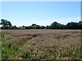
Pond Field
The name of the field according to Ferring's 1837 tithe map that is located to the south of Image and Image, east of Sea Lane and north of a private dwelling called The Hayloft.
Image: © Simon Carey
Taken: 6 Aug 2017
0.08 miles
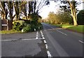
7
Somerset Road, Ferring
A residential road that links Sea Lane to Jersey Road that was built in the 1950s. Once a field called Great Man's Field according to Ferring's 1837 tithe map.
Image: © Simon Carey
Taken: 6 Aug 2017
0.10 miles
8
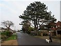
Conifer, Cycle and Care Home
Bus stop for Compass bus route 8A in Beehive Lane outside Scotch Dyke, BN12 5NR (residential care home).
Image: © Peter Holmes
Taken: 11 Feb 2017
0.10 miles
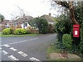
9
Bus Stop, Sea Lane, Ferring
Stop for 8A Compass route to Worthing at junction with Sea Lane Gardens.
Image: © Peter Holmes
Taken: 27 Dec 2016
0.12 miles
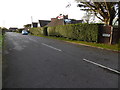
10
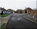
Corner Garth, BN12 5EL
Bungalows in cul-de-sac.
Image: © Peter Holmes
Taken: 27 Jan 2017
0.12 miles