
IMAGES TAKEN NEAR TO
Sea Lane Gardens, WORTHING, BN12 5EQ
Introduction
This page details the photographs taken nearby to Sea Lane Gardens, BN12 5EQ by members of the Geograph project.
The Geograph project started in 2005 with the aim of publishing, organising and preserving representative images for every square kilometre of Great Britain, Ireland and the Isle of Man.

There are currently over 7.5m images from over14,400 individuals and you can help contribute to the project by visiting https://www.geograph.org.uk
Image Map
Images are licensed for reuse under creativecommons.org/licenses/by-sa/2.0
Notes
- Clicking on the map will re-center to the selected point.
- The higher the marker number, the further away the image location is from the centre of the postcode.
Image Listing (101 Images Found)
Images are licensed for reuse under creativecommons.org/licenses/by-sa/2.0
Image
Details
Distance
1
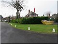
House with Red Ensign
Also known as the Red Duster flying in Sea Lane Gardens BN12 5EQ.
Image: © Peter Holmes
Taken: 27 Jan 2017
0.03 miles
2
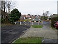
Barrier in Sea Lane Gardens, BN12 5EQ
Division between north and south sections of Sea Lane Gardens.
Image: © Peter Holmes
Taken: 27 Jan 2017
0.03 miles
3
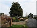
Sea Lane Gardens, BN12 5EG
Large conifer with heather beds frontage.
Image: © Peter Holmes
Taken: 27 Jan 2017
0.05 miles
4
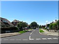
Sea Lane Gardens, Ferring
A residential road developed around 1960. This is the southern junction with Sea Lane.
Image: © Simon Carey
Taken: 6 Aug 2017
0.06 miles
5
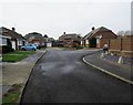
Corner Garth, BN12 5EL
Bungalows in cul-de-sac.
Image: © Peter Holmes
Taken: 27 Jan 2017
0.09 miles
6
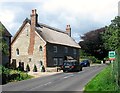
Bramble Cottage, Sea Lane, Ferring
Built sometime between 1635-57 as a single dwelling that was later converted to two cottages in the early 19th century before returning to a single dwelling after the Second World War. Once the southernmost dwelling of the old hamlet of East Ferring.
Image: © Simon Carey
Taken: 6 Aug 2017
0.09 miles
7
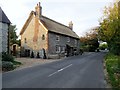
Bramble Cottage, Sea Lane, BN12 5EH
Grade II listed building.
Image: © Peter Holmes
Taken: 30 Oct 2016
0.09 miles
8
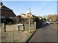
Bus Stop, Sea Lane, Ferring
Stop for 8A Compass route to Worthing at junction with Sea Lane Gardens.
Image: © Peter Holmes
Taken: 27 Dec 2016
0.11 miles
9
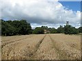
Saunders Croft
The name of the field according to Ferring's 1837 tithe map that is bounded by Sea Lane to the west, Image to the east and Image to the south.
Image: © Simon Carey
Taken: 6 Aug 2017
0.12 miles
10
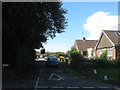
East Mead, Ferring
A cul de sac off Sea Lane built in the late 1950s. Partially located on a former field called Lucerne Field according to Ferring's 1837 tithe map.
Image: © Simon Carey
Taken: 6 Aug 2017
0.12 miles