IMAGES TAKEN NEAR TO
Park Drive, WORTHING, BN12 5DX
Introduction
This page details the photographs taken nearby to Park Drive, BN12 5DX by members of the Geograph project.
The Geograph project started in 2005 with the aim of publishing, organising and preserving representative images for every square kilometre of Great Britain, Ireland and the Isle of Man.

There are currently over 7.5m images from over14,400 individuals and you can help contribute to the project by visiting https://www.geograph.org.uk
Image Map
Images are licensed for reuse under creativecommons.org/licenses/by-sa/2.0
Notes
- Clicking on the map will re-center to the selected point.
- The higher the marker number, the further away the image location is from the centre of the postcode.
Image Listing (147 Images Found)
Images are licensed for reuse under creativecommons.org/licenses/by-sa/2.0
Image
Details
Distance
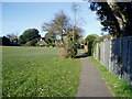
1
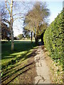
Public Footpath 2119
Linking Sea Lane with Church Lane the path adjoins Ferring Cricket Club ground.
Image: © Peter Holmes
Taken: 14 Mar 2010
0.04 miles
2
Footpath 2119, Ferring
Linking Ferring Street to Sea Lane and running along the northern side of Image
Image: © Simon Carey
Taken: 6 Aug 2017
0.04 miles
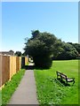
3
Little Twitten Recreation Ground
Public footpath 2119 connecting Sea Lane with Church Lane.
Image: © Peter Holmes
Taken: 14 Mar 2010
0.06 miles
4
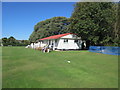
Ferring Cricket Pavilion
Teams retire to the pavilion for tea. http://www.ferringcricket.co.uk/
Image: © Peter Holmes
Taken: 11 Sep 2016
0.06 miles
5
Public Footpath 2119
Linking Sea Lane with Church Lane the path adjoins Ferring Cricket Club ground.
Image: © Peter Holmes
Taken: 14 Mar 2010
0.06 miles
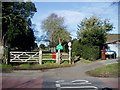
6
Sea Lane
At junction with Sea Lane Close.
Image: © Peter Holmes
Taken: 8 Feb 2015
0.07 miles
7
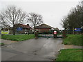
No School Today
Ferring Church of England Primary School at Midday Christmas 2015.
Image: © Peter Holmes
Taken: 25 Dec 2015
0.07 miles
8
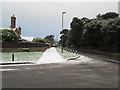
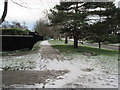
Snowy pavement
Looking west along Sea Lane.
Image: © Peter Holmes
Taken: 31 Jan 2015
0.07 miles
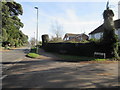
9

Homestead Cottages, Sea Lane, Ferring
Three sets of semi-detached cottages built after the Second World War.
Image: © Simon Carey
Taken: 6 Aug 2017
0.07 miles
10
Footpath to Ferring School
Snowy path adjacent to Sea Lane.
Image: © Peter Holmes
Taken: 31 Jan 2015
0.08 miles