IMAGES TAKEN NEAR TO
Marine Crescent, WORTHING, BN12 4HP
Introduction
This page details the photographs taken nearby to Marine Crescent, BN12 4HP by members of the Geograph project.
The Geograph project started in 2005 with the aim of publishing, organising and preserving representative images for every square kilometre of Great Britain, Ireland and the Isle of Man.

There are currently over 7.5m images from over14,400 individuals and you can help contribute to the project by visiting https://www.geograph.org.uk
Image Map (Loading...)


Getting Data...Please wait
Leaflet Map data © OpenStreetMap
Images are licensed for reuse under creativecommons.org/licenses/by-sa/2.0
Notes
- Clicking on the map will re-center to the selected point.
- The higher the marker number, the further away the image location is from the centre of the postcode.
Image Listing (135 Images Found)
Images are licensed for reuse under creativecommons.org/licenses/by-sa/2.0
Image
Details
Distance
2
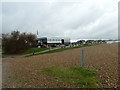
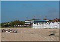
Seats between Goring Beach and the Sea Lane Caf
Image: © Basher Eyre
Taken: 4 Dec 2010
0.02 miles
3
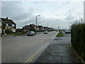
Looking towards the bottom end of Sea Lane
Image: © Basher Eyre
Taken: 4 Dec 2010
0.02 miles
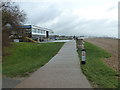
5
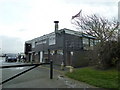
Sea Lane Caf?, Worthing
The only café at the Western end of Worthing, it is always very popular - wonderful cream cakes!
Image: © David Boness
Taken: 20 Jun 2006
0.03 miles
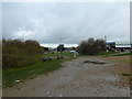
8
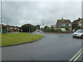
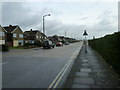
Junction of Marine Crescent and Sea Lane
Image: © Basher Eyre
Taken: 4 Dec 2010
0.03 miles
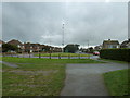
9
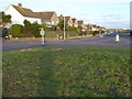
Looking east from the roundabout at the southern end of Sea Lane
The roundabout is seen at http://www.geograph.org.uk/photo/2188499.
Image: © Shazz
Taken: 21 Nov 2015
0.03 miles