
IMAGES TAKEN NEAR TO
Prince Albert Street, BRIGHTON, BN1 1HY
Introduction
This page details the photographs taken nearby to Prince Albert Street, BN1 1HY by members of the Geograph project.
The Geograph project started in 2005 with the aim of publishing, organising and preserving representative images for every square kilometre of Great Britain, Ireland and the Isle of Man.

There are currently over 7.5m images from over14,400 individuals and you can help contribute to the project by visiting https://www.geograph.org.uk
Image Map
Images are licensed for reuse under creativecommons.org/licenses/by-sa/2.0
Notes
- Clicking on the map will re-center to the selected point.
- The higher the marker number, the further away the image location is from the centre of the postcode.
Image Listing (1854 Images Found)
Images are licensed for reuse under creativecommons.org/licenses/by-sa/2.0
Image
Details
Distance
1

Friends Meeting House
Built in 1805, the Meeting House is the place of worship for the city's Quakers and a grade two star listed building.
http://www.brightonquakers.co.uk/
Image: © Paul Gillett
Taken: 21 Feb 2010
0.01 miles
2

Meeting House Lane, Brighton
Meeting House Lane, in The Lanes area of Brighton.
Image: © Malc McDonald
Taken: 10 Apr 2011
0.01 miles
3
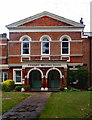
Friends Meeting House, Brighton
Grade II listed building from 1805 with later alterations and extensions - description at this https://historicengland.org.uk/listing/the-list/list-entry/1380935.
Image: © Jim Osley
Taken: 5 Sep 2016
0.01 miles

5
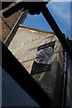
Brighton: ghost-sign, Meeting House Lane
Image: © Christopher Hilton
Taken: 26 Mar 2019
0.01 miles
6

Pecksniff's, Meeting House Lane
The entrance to the fragrance shop in The Lanes that has been operating for thirty years. Viewed from an alley that links Brighton Square to Meeting House Lane.
Image: © Simon Carey
Taken: 14 Aug 2011
0.02 miles
7
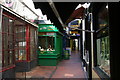
Brighton; Meeting House Lane, in The Lanes
Meeting House Lane contains a dense clutch of jeweller's shops.
Image: © Christopher Hilton
Taken: 26 Mar 2019
0.02 miles
8

The Lanes, Brighton
The lanes are a series of narrow passages in the centre of Brighton, once the main part of town and home to the local fishermen. These days they are an independent shopping area full of jewellers and antique shops.
Image: © Simon Carey
Taken: 25 Dec 2005
0.02 miles
9

Meeting House Lane, Brighton
Another area of the lanes were the path briefly forks west then north. Jewellers on the left, antique armourer on the right and the Bath Arms straight ahead.
Image: © Simon Carey
Taken: 25 Dec 2005
0.02 miles
10

Union Street
Opposite the entrance to Bond Street is the entrance the area known as The Lanes. Head south down Meeting House Lane then west into Union Street. In fact Union Street used to be Meeting House Lane but was changed in the late 19th century. This is the old town of narrow walkways in areas once inhabited by fisherman but now filled with trendy shops. The building to the left is a former chapel rebuilt in 1825 on the site of one erected in 1698. The chapel was converted into The Font and Firkin pub in 1990 and still retains a circular plan with open balconies. It is also reputed to be haunted.
Click on the link to take you to the next page. http://www.geograph.org.uk/photo/230692
Image: © Simon Carey
Taken: 1 Sep 2006
0.02 miles