
IMAGES TAKEN NEAR TO
Market Street, BRIGHTON, BN1 1HH
Introduction
This page details the photographs taken nearby to Market Street, BN1 1HH by members of the Geograph project.
The Geograph project started in 2005 with the aim of publishing, organising and preserving representative images for every square kilometre of Great Britain, Ireland and the Isle of Man.

There are currently over 7.5m images from over14,400 individuals and you can help contribute to the project by visiting https://www.geograph.org.uk
Image Map
Images are licensed for reuse under creativecommons.org/licenses/by-sa/2.0
Notes
- Clicking on the map will re-center to the selected point.
- The higher the marker number, the further away the image location is from the centre of the postcode.
Image Listing (1955 Images Found)
Images are licensed for reuse under creativecommons.org/licenses/by-sa/2.0
Image
Details
Distance
1

Market Street
This small street was once known as Golden Lion Lane but took on the name of the then principal food shopping street in the old town from around the 18th century becoming a northern extension to East Street. Many of the houses date from the late 18th-early 19th centuries and are by and large either restaurants, cafes and the odd gift shop. The former taking advantage of the pedestrianisation of the street in 1989.
Image: © Simon Carey
Taken: 30 Oct 2011
0.00 miles
2
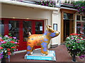
Snowdog #18, Brighton Place
at the East of the Lanes
Image: © Paul Gillett
Taken: 26 Sep 2016
0.00 miles
3

House of Correction
House of Correction Brighton Lanes
Image: © cynthia hudson
Taken: 14 Sep 2012
0.01 miles
4
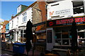
Brighton; Market Street, in The Lanes
Image: © Christopher Hilton
Taken: 26 Mar 2019
0.01 miles
5

The Lanes, Brighton
Seen from East Street looking into The Lanes.
Image: © Stephen McKay
Taken: 10 Dec 2007
0.01 miles
6

Market Street
Once an open area called The Knab which contained the town's well. The pub at the bottom of the slope is the Sussex which is the only building which separates this road from East Street and dates back to the 18th century when it was reputed to be a local smugglers haunt called The Spread Eagle. It has been known by its current name since 1816. The area was pedestrianised in 1989.
Image: © Simon Carey
Taken: 30 Oct 2011
0.01 miles
7

Snailspace #25 Donatello Restaurant
Title: Around the Whirled
Artist: Peter Poole
Sponsor: Donatello Restaurant https://www.donatello.co.uk/
Image: © Paul Gillett
Taken: 17 Sep 2018
0.01 miles
8

Market Street, Brighton
Originally this area was known as the Knab due to it being on a slight rise above the former marshy ground around the Old Steine to the east. This section of the street was originally known as Golden Lion Lane and was developed in the 17th and 18th centuries. It was pedestrianised in 1989 and heads down the slope to East Street.
Image: © Simon Carey
Taken: 20 Sep 2015
0.01 miles
9

Market Street, Brighton
This is part of The Lanes in Brighton.
Image: © Marathon
Taken: 14 Aug 2022
0.01 miles
10

Market Street, Brighton
This is part of The Lanes in Brighton.
Image: © Marathon
Taken: 14 Aug 2022
0.01 miles