IMAGES TAKEN NEAR TO
Treveor Close, WORTHING, BN11 4AD
Introduction
This page details the photographs taken nearby to Treveor Close, BN11 4AD by members of the Geograph project.
The Geograph project started in 2005 with the aim of publishing, organising and preserving representative images for every square kilometre of Great Britain, Ireland and the Isle of Man.

There are currently over 7.5m images from over14,400 individuals and you can help contribute to the project by visiting https://www.geograph.org.uk
Image Map
Images are licensed for reuse under creativecommons.org/licenses/by-sa/2.0
Notes
- Clicking on the map will re-center to the selected point.
- The higher the marker number, the further away the image location is from the centre of the postcode.
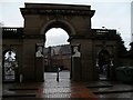
Image Listing (345 Images Found)
Images are licensed for reuse under creativecommons.org/licenses/by-sa/2.0
Image
Details
Distance
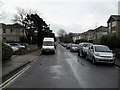
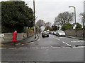
4
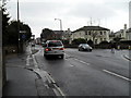
Wet, wetter, wettest
Taken towards the end of a long, hard, and very wet day's geographing- this one is in Richmond Road.
Image: © Basher Eyre
Taken: 16 Feb 2010
0.04 miles
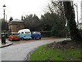
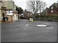
6
Approaching a mini-roundabout in Richmond Road
Image: © Basher Eyre
Taken: 16 Feb 2010
0.04 miles
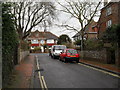
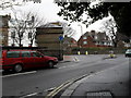
8
Looking from Richmond Road into Victoria Road
Image: © Basher Eyre
Taken: 16 Feb 2010
0.04 miles