IMAGES TAKEN NEAR TO
Ham Way, WORTHING, BN11 2QF
Introduction
This page details the photographs taken nearby to Ham Way, BN11 2QF by members of the Geograph project.
The Geograph project started in 2005 with the aim of publishing, organising and preserving representative images for every square kilometre of Great Britain, Ireland and the Isle of Man.

There are currently over 7.5m images from over14,400 individuals and you can help contribute to the project by visiting https://www.geograph.org.uk
Image Map
Images are licensed for reuse under creativecommons.org/licenses/by-sa/2.0
Notes
- Clicking on the map will re-center to the selected point.
- The higher the marker number, the further away the image location is from the centre of the postcode.
Image Listing (130 Images Found)
Images are licensed for reuse under creativecommons.org/licenses/by-sa/2.0
Image
Details
Distance
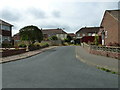
2
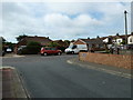
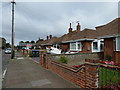
Ham Way, Worthing
A residential road that links Ham Road, the B2223, with Oakleigh Road. It was constructed during the 1930s.
Image: © Simon Carey
Taken: 31 Mar 2024
0.02 miles
4
Ham Close
Not the RC church in the background.
Image: © Basher Eyre
Taken: 18 Jul 2010
0.02 miles
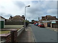
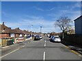
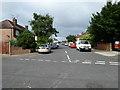
7
Approaching the junction of Oakleigh Road and Ham Way
Image: © Basher Eyre
Taken: 18 Jul 2010
0.04 miles
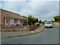
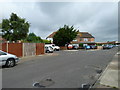
8
Ham Close, Worthing
A cul de sac off Ham Way that was constructed in the 1960s.
Image: © Simon Carey
Taken: 31 Mar 2024
0.04 miles
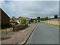
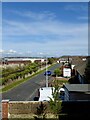
10
Looking from Oakleigh Road into Ham Way
Image: © Basher Eyre
Taken: 18 Jul 2010
0.05 miles