IMAGES TAKEN NEAR TO
Ham Road, WORTHING, BN11 2QB
Introduction
This page details the photographs taken nearby to Ham Road, BN11 2QB by members of the Geograph project.
The Geograph project started in 2005 with the aim of publishing, organising and preserving representative images for every square kilometre of Great Britain, Ireland and the Isle of Man.

There are currently over 7.5m images from over14,400 individuals and you can help contribute to the project by visiting https://www.geograph.org.uk
Image Map
Images are licensed for reuse under creativecommons.org/licenses/by-sa/2.0
Notes
- Clicking on the map will re-center to the selected point.
- The higher the marker number, the further away the image location is from the centre of the postcode.
Image Listing (153 Images Found)
Images are licensed for reuse under creativecommons.org/licenses/by-sa/2.0
Image
Details
Distance
1
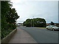
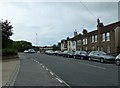
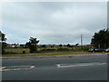
Ham Road in Worthing, West Sussex
This shows housing by the B2223 near the junction with Pages Lane.
Image: © Roger D Kidd
Taken: 2 Jan 2016
0.01 miles
5
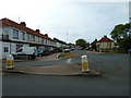
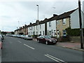
Approaching the junction of Chesswood and Ham Roads
Image: © Basher Eyre
Taken: 18 Jul 2010
0.04 miles
7
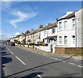
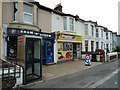
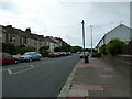
198-246, Ham Road, Worthing
The housing is located on the eastern side of the B2223 as far as Ham Way and was developed in the 1880s as housing for workers in the nearby glasshouse industry.
Image: © Simon Carey
Taken: 31 Mar 2024
0.05 miles