IMAGES TAKEN NEAR TO
Seamill Park Crescent, WORTHING, BN11 2PS
Introduction
This page details the photographs taken nearby to Seamill Park Crescent, BN11 2PS by members of the Geograph project.
The Geograph project started in 2005 with the aim of publishing, organising and preserving representative images for every square kilometre of Great Britain, Ireland and the Isle of Man.

There are currently over 7.5m images from over14,400 individuals and you can help contribute to the project by visiting https://www.geograph.org.uk
Image Map
Images are licensed for reuse under creativecommons.org/licenses/by-sa/2.0
Notes
- Clicking on the map will re-center to the selected point.
- The higher the marker number, the further away the image location is from the centre of the postcode.
Image Listing (95 Images Found)
Images are licensed for reuse under creativecommons.org/licenses/by-sa/2.0
Image
Details
Distance
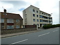
4
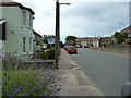
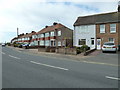
Looking from Meadow Road towards a bus in Brougham Road
Image: © Basher Eyre
Taken: 18 Jul 2010
0.05 miles
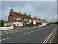
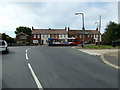
6
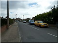
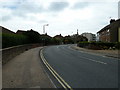
Seamill Park Road, Worthing
A residential road linking Brighton Road, the A259, with Seamill Park Crescent. It was built around the beginning of the 1930s.
Image: © Simon Carey
Taken: 31 Mar 2024
0.05 miles
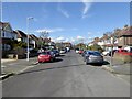
8
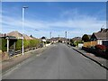
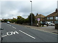
Seamill Way, Worthing
A residential road connecting Meadow Road with Seamill Park Crescent that was built in the 1950s on the site of Frampton's Nurseries.
Image: © Simon Carey
Taken: 31 Mar 2024
0.06 miles