IMAGES TAKEN NEAR TO
Station Road, WORTHING, BN11 1JY
Introduction
This page details the photographs taken nearby to Station Road, BN11 1JY by members of the Geograph project.
The Geograph project started in 2005 with the aim of publishing, organising and preserving representative images for every square kilometre of Great Britain, Ireland and the Isle of Man.

There are currently over 7.5m images from over14,400 individuals and you can help contribute to the project by visiting https://www.geograph.org.uk
Image Map
Images are licensed for reuse under creativecommons.org/licenses/by-sa/2.0
Notes
- Clicking on the map will re-center to the selected point.
- The higher the marker number, the further away the image location is from the centre of the postcode.
Image Listing (67 Images Found)
Images are licensed for reuse under creativecommons.org/licenses/by-sa/2.0
Image
Details
Distance
1
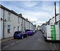
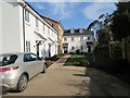
Station Road, Worthing
The road was laid out after the arrival of the railway though the cottages in view were not built until the early 1880s.
Image: © Simon Carey
Taken: 31 Mar 2024
0.02 miles
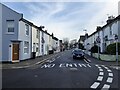
2
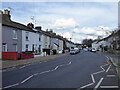
Newland Road, Worthing
Linking Broadwater Road, the A24, to the junction with Station Road whereupon it becomes Chesswood Road. The houses were built in the 1880s.
Image: © Simon Carey
Taken: 31 Mar 2024
0.03 miles
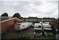
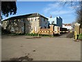
5
East & West Sidings, Station Road, BN11 1JY
Newbuild leasehold properties on brown field site.
Image: © Peter Holmes
Taken: 13 Feb 2017
0.06 miles
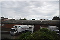
6
Exit from Homefield Park
Leading to Newland Road.
Image: © Peter Holmes
Taken: 13 Feb 2017
0.06 miles
7
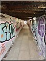
Quashett Bridge, Worthing
Linking Ivy Arch Road to Station Road underneath the railway line. The name is marked as such on Worthing's 1851 tithe map and follows an ancient route south from Broadwater to the sea.
Image: © Simon Carey
Taken: 31 Mar 2024
0.08 miles
8
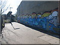
Urban Graffiti
Adjacent to public footpath 3137.
Image: © Peter Holmes
Taken: 17 Feb 2015
0.08 miles
9
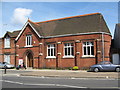
Newland Road
This building was originally St George's Mission Room, it opened in 1883 and closed in 1936.
Image: © Josie Campbell
Taken: 17 Jun 2008
0.09 miles
10
Dagmar Street, Worthing
A residential street linking Station Road to Newlands Road that was developed in the 1870s.
Image: © Simon Carey
Taken: 31 Mar 2024
0.09 miles