IMAGES TAKEN NEAR TO
Stanley Road, WORTHING, BN11 1DT
Introduction
This page details the photographs taken nearby to Stanley Road, BN11 1DT by members of the Geograph project.
The Geograph project started in 2005 with the aim of publishing, organising and preserving representative images for every square kilometre of Great Britain, Ireland and the Isle of Man.

There are currently over 7.5m images from over14,400 individuals and you can help contribute to the project by visiting https://www.geograph.org.uk
Image Map
Images are licensed for reuse under creativecommons.org/licenses/by-sa/2.0
Notes
- Clicking on the map will re-center to the selected point.
- The higher the marker number, the further away the image location is from the centre of the postcode.
Image Listing (171 Images Found)
Images are licensed for reuse under creativecommons.org/licenses/by-sa/2.0
Image
Details
Distance
1

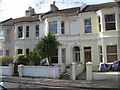
Terraced housing in Stanley Road
Victorian properties built in the 1870/80s for middle-class professionals.
Image: © Peter Holmes
Taken: 10 Feb 2015
0.02 miles
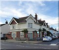
2
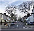
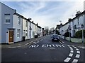
Upper High Street, Worthing
A residential road linking Newlands Road to High Street, the A259, that was developed in the 1880s.
Image: © Simon Carey
Taken: 31 Mar 2024
0.03 miles
3
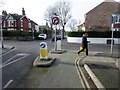
East end of Tower Road
At junction with Upper High Street, one-way street south only. T'other side is Sussex Road.
Image: © Peter Holmes
Taken: 3 Jan 2017
0.05 miles
4
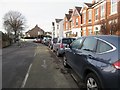
Tower Road, BN11 1DP
One-way street for traffic travelling west with dedicated cycle lane for bikes travelling east.
Image: © Peter Holmes
Taken: 3 Jan 2017
0.06 miles
5
Residential development, Newland Road
Previously The Globe public house which closed on 29th October 2009.
Image: © Peter Holmes
Taken: 10 Feb 2015
0.06 miles
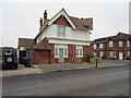
6
73, Newland Road, Worthing
The current block of flats located on the corner of Dagmar Street and newland Road was once The Globe public house, first opened in 1866, then rebuilt in the 1900s. It closed in 2013.
Image: © Simon Carey
Taken: 31 Mar 2024
0.06 miles
7
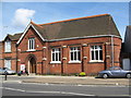
Newland Road
This building was originally St George's Mission Room, it opened in 1883 and closed in 1936.
Image: © Josie Campbell
Taken: 17 Jun 2008
0.07 miles
8
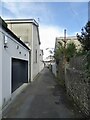
The Old Stables, Station Road, Worthing
A view of the rear of the former stables converted into flats.
Image: © Simon Carey
Taken: 31 Mar 2024
0.07 miles
9
Dagmar Street, Worthing
A residential street linking Station Road to Newlands Road that was developed in the 1870s.
Image: © Simon Carey
Taken: 31 Mar 2024
0.07 miles