
IMAGES TAKEN NEAR TO
South Coast Road, PEACEHAVEN, BN10 8NP
Introduction
This page details the photographs taken nearby to South Coast Road, BN10 8NP by members of the Geograph project.
The Geograph project started in 2005 with the aim of publishing, organising and preserving representative images for every square kilometre of Great Britain, Ireland and the Isle of Man.

There are currently over 7.5m images from over14,400 individuals and you can help contribute to the project by visiting https://www.geograph.org.uk
Image Map
Images are licensed for reuse under creativecommons.org/licenses/by-sa/2.0
Notes
- Clicking on the map will re-center to the selected point.
- The higher the marker number, the further away the image location is from the centre of the postcode.
Image Listing (59 Images Found)
Images are licensed for reuse under creativecommons.org/licenses/by-sa/2.0
Image
Details
Distance
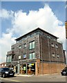
2
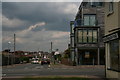
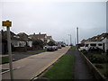
Keymer Avenue, Peacehaven
See https://en.wikipedia.org/wiki/Peacehaven
Peacehaven is characterised by the grid system of its streets, and seemingly the concrete roadways, here visible beyond the white car.
The town was originally formed for retiring WWI veterans in order for them to escape and recover from the effects of the war. The idyllic setting, sea air and simple lifestyle were thought to have aided good health. The land was also cheap and, as a result, working-class families from the city started to purchase plots and gradually build makeshift homes for weekends and holidays. This movement of frontier style buildings made with whatever materials were available at the time was termed as the Plotlands movement. Inhabitants felt a sense of freedom in living off what they needed and enjoying a simpler life away from the busy, polluted city. The Plotlands provided the working class an opportunity that might not have been available otherwise.
Image: © Chris
Taken: 11 Jun 2016
0.05 miles
6
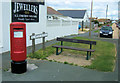
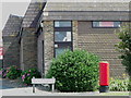
Slindon Avenue with Gracie Fields Seat, Peacehaven
This is Postbox BN10 645. The seat on the right is dedicated to Dame Gracie Fields (1889 - 1979) Gracie Fields bought a house in Dorothy Avenue for her mother, Sarah Stansfield in the 1930s. Her mother did not like the house and it was later converted into an Orphanage under Gracie's patronage.
Image: © Kevin Gordon
Taken: 20 Jul 2008
0.06 miles
7
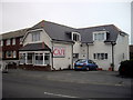
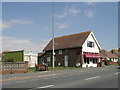
The Pantry Caf?, South Coast Road, Peacehaven
Image: © PAUL FARMER
Taken: 25 Jun 2011
0.08 miles
8
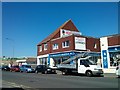
Martlets Hospice Shop, South Coast Road, Newhaven
Image: © PAUL FARMER
Taken: 4 Sep 2013
0.09 miles
9
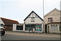
Fishing shop on the South Coast Road through Peacehaven
Image: © Chris
Taken: 11 Jun 2016
0.09 miles
10
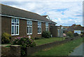
Peacehaven Evangelical Church, South Coast Road, Peacehaven
Image: © Kevin Gordon
Taken: 20 Jul 2008
0.09 miles