
IMAGES TAKEN NEAR TO
The Promenade, PEACEHAVEN, BN10 8LN
Introduction
This page details the photographs taken nearby to The Promenade, BN10 8LN by members of the Geograph project.
The Geograph project started in 2005 with the aim of publishing, organising and preserving representative images for every square kilometre of Great Britain, Ireland and the Isle of Man.

There are currently over 7.5m images from over14,400 individuals and you can help contribute to the project by visiting https://www.geograph.org.uk
Image Map
Images are licensed for reuse under creativecommons.org/licenses/by-sa/2.0
Notes
- Clicking on the map will re-center to the selected point.
- The higher the marker number, the further away the image location is from the centre of the postcode.
Image Listing (147 Images Found)
Images are licensed for reuse under creativecommons.org/licenses/by-sa/2.0
Image
Details
Distance

2

Promenade, Peacehaven
Rough seafront road.
Image: © Oast House Archive
Taken: 10 Oct 2010
0.02 miles
3
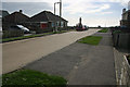
Airy Greenwich meridian at the south coast
This picture was taken standing on the Airy Greenwich meridian line. The airy line just clips the corner of the bungalow in the middle of the picture. The monument is located on the Bradley meridian 6m further west. See this http://www.riddlerworld.co.uk/meridian/PG0088.htm for an alternate image with the Airy and Bradley meridians superimposed as green and yellow lines.
Image: © steve ridley
Taken: 27 Feb 2011
0.02 miles
4
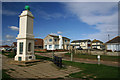
Greenwich Meridian monument Peacehaven
This picture was taken standing on the Airy Greenwich meridian line. The Airy line just clips the corner of the bungalow on the extreme right of the picture. The monument is located on the Bradley meridian 6m further west. See this http://www.riddlerworld.co.uk/meridian/PG0079.htm for an alternate image with the Airy and Bradley meridians superimposed as green and yellow lines.
Image: © steve ridley
Taken: 27 Feb 2011
0.02 miles
5

Greenwich Meridian at the south coast
This picture was taken standing on the Bradley Greenwich Meridian looking South. The meridian passes straight through the middle, see http://www.riddlerworld.co.uk/meridian/PG0087.htm for an alternate image with the meridian superimposed as a green line. The meridian crosses Horsham avenue and passes through the meridian monument on the top of the cliffs.
Image: © steve ridley
Taken: 23 Jan 2011
0.02 miles
6

Greenwich meridian monument shadow
This picture was taken standing on the Bradley Greenwich meridian looking North. The meridian passes straight through the middle, see this http://www.riddlerworld.co.uk/meridian/PG0080.htm for an alternate image with the meridian superimposed as a green line. This picture was taken with my back to the Meridian monument at solar midday, (adjusted for the equation of time), so the shadow of the monument lies directly along the meridian line.
Image: © steve ridley
Taken: 27 Feb 2011
0.02 miles
7
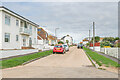
Dorothy Avenue
Residential road in Peacehaven.
Image: © Ian Capper
Taken: 20 Sep 2022
0.02 miles
8
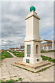
Meridian Monument
Monument at the point where the Greenwich Meridian meets the English Channel, consisting of a square pillar topped by a copper globe. (To be more precise it is the Meridian defined in the mid 18th Century by the Astronomer Royal at the time, James Bradley, and as used for most UK mapping purposes, as opposed to the later 1851 Meridian, defined in 1851 by another Astronomer Royal, Sir George Biddell Airy, which is the internationally recognised version for timekeeping purposes and which at this point is 5.9 metres to the east of here.)
The monument, designed by architect R W H Jones (who was also responsible for the Saltdean Lido and the Ocean Hotel in Saltdean) was unveiled on 8 August 1936, the brainchild of land agent and founder of Peacehaven, Charles Neville, following an observation by a resident Commander W S Davenport that the Greenwich Meridian passed through the town. It seems that the original intention was that the memorial should commemorate the Silver Jubilee of King George V in 1935, but this had passed (and the King had died) by the time it was erected. Instead the obelisk was officially named the King George V Memorial and Prime Meridian Obelisk.
Cliff erosion (or associated sea defence work) has meant that the monument has had to be moved inland from its original position, firstly by 30 ft in the 1960s and then by a further 24 ft in the early 1980s.
The globe on top of the pillar is a replacement of the original which was lost in the 1987 storm.
For a close up of the plaques on the south face, see Image
Image: © Ian Capper
Taken: 20 Sep 2022
0.03 miles
9

Plaques, Meridian Monument
Plaques on the south face of the Meridian Monument, a monument at the point where the Greenwich Meridian meets the English Channel, consisting of a square pillar topped by a copper globe, designed by architect R W H Jones.
For a wider view showing the position of the plaques on the monument, see Image
The plaques read (from top to bottom):
"Peacehaven King George V. Memorial. Erected by the inhabitants in the year 1936 to commemorate the beneficent and illustrious reign of their beloved sovereign (1910 - 1936) and to mark Peacehaven's position on the prime meridian of Greenwich."
then:
This plaque was placed by the Lord Lieutenant Peter Field and the Mayor of Peacehaven Cllr Robert Robertson to mark Meridian Day June 26th 2014."
and:
This stone was laid on May 30th 1936 by C W Neville Esq, the founder of Peacehaven (in the year 1919)."
Image: © Ian Capper
Taken: 20 Sep 2022
0.03 miles
10
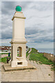
Meridian Monument
Monument at the point where the Greenwich Meridian meets the English Channel, consisting of a square pillar topped by a copper globe. (To be more precise it is the Meridian defined in the mid 18th Century by the Astronomer Royal at the time, James Bradley, and as used for most UK mapping purposes, as opposed to the later 1851 Meridian, defined in 1851 by another Astronomer Royal, Sir George Biddell Airy, which is the internationally recognised version for timekeeping purposes and which at this point is 5.9 metres to the east of here.)
The monument, designed by architect R W H Jones (who was also responsible for the Saltdean Lido and the Ocean Hotel in Saltdean) was unveiled on 8 August 1936, the brainchild of land agent and founder of Peacehaven, Charles Neville, following an observation by a resident Commander W S Davenport that the Greenwich Meridian passed through the town. It seems that the original intention was that the memorial should commemorate the Silver Jubilee of King George V in 1935, but this had passed (and the King had died) by the time it was erected. Instead the obelisk was officially named the King George V Memorial and Prime Meridian Obelisk.
Cliff erosion (or associated sea defence work) has meant that the monument has had to be moved inland from its original position, firstly by 30 ft in the 1960s and then by a further 24 ft in the early 1980s.
The globe on top of the pillar is a replacement of the original which was lost in the 1987 storm.
Image: © Ian Capper
Taken: 20 Sep 2022
0.03 miles