
IMAGES TAKEN NEAR TO
South Coast Road, PEACEHAVEN, BN10 8JP
Introduction
This page details the photographs taken nearby to South Coast Road, BN10 8JP by members of the Geograph project.
The Geograph project started in 2005 with the aim of publishing, organising and preserving representative images for every square kilometre of Great Britain, Ireland and the Isle of Man.

There are currently over 7.5m images from over14,400 individuals and you can help contribute to the project by visiting https://www.geograph.org.uk
Image Map
Images are licensed for reuse under creativecommons.org/licenses/by-sa/2.0
Notes
- Clicking on the map will re-center to the selected point.
- The higher the marker number, the further away the image location is from the centre of the postcode.
Image Listing (141 Images Found)
Images are licensed for reuse under creativecommons.org/licenses/by-sa/2.0
Image
Details
Distance
2
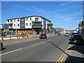
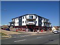
South Coast Road, Peacehaven
South Coast Road is on the route of the A259 as it passes through Peacehaven on the Sussex coast.
Image: © Malc McDonald
Taken: 24 Jul 2022
0.02 miles
4
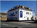
The White Schooner public house, Peacehaven
Image: © Stacey Harris
Taken: 19 Jun 2012
0.04 miles
5

South Coast Road, Peacehaven
South Coast Road is on the route of the A259 as it passes through Peacehaven, on the Sussex coast.
Image: © Malc McDonald
Taken: 24 Jul 2022
0.05 miles

7

Greenwich Meridian crossing the A259
This picture was taken standing on the Bradley Greenwich meridian looking North. The meridian passes straight through the middle, see this http://www.riddlerworld.co.uk/meridian/PG0097.htm for an alternate image with the meridian superimposed as a green line. Here the meridian crosses the A259 Coast road and right through the middle of an estate agent opposite. The parking bollard is more or less on the Bradley Meridian line.
Image: © steve ridley
Taken: 23 Jan 2011
0.07 miles
8

Greenwich Meridian crossing a car park
This picture was taken standing on the Bradley Greenwich meridian looking North. The meridian passes straight through the middle, see this http://www.riddlerworld.co.uk/meridian/PG0094.htm for an alternate image with the meridian superimposed as a green line. Here the meridian crosses a car park just behind the shops on the A259 Coast road.
Image: © steve ridley
Taken: 23 Jan 2011
0.08 miles
9
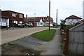
Greenwich Meridian crossing Edith Avenue
This picture was taken standing on the Bradley Greenwich meridian looking South. The meridian passes straight through the middle, see this http://www.riddlerworld.co.uk/meridian/PG0106.htm for an alternate image with the meridian superimposed as a green line. The meridian crosses Edith Avenue diagonally in this picture.
Image: © steve ridley
Taken: 23 Jan 2011
0.09 miles
10

Horsham Avenue
Another road with many different sections. This part looks from the southern junction with The Promenade near the cliff top and looks towards the South Coast Road, the A259. It then continues northward to Arundel Road before being separated from its northern section between Balcombe Road and Firle Road by the Meridian Centre.
Image: © Simon Carey
Taken: 15 Mar 2009
0.09 miles