IMAGES TAKEN NEAR TO
Bridges Avenue, BURY, BL9 9RJ
Introduction
This page details the photographs taken nearby to Bridges Avenue, BL9 9RJ by members of the Geograph project.
The Geograph project started in 2005 with the aim of publishing, organising and preserving representative images for every square kilometre of Great Britain, Ireland and the Isle of Man.

There are currently over 7.5m images from over14,400 individuals and you can help contribute to the project by visiting https://www.geograph.org.uk
Image Map (Loading...)


Getting Data...Please wait
Leaflet Map data © OpenStreetMap
Images are licensed for reuse under creativecommons.org/licenses/by-sa/2.0
Notes
- Clicking on the map will re-center to the selected point.
- The higher the marker number, the further away the image location is from the centre of the postcode.
Image Listing (31 Images Found)
Images are licensed for reuse under creativecommons.org/licenses/by-sa/2.0
Image
Details
Distance
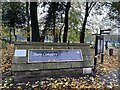
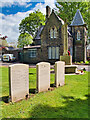
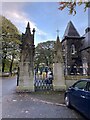
2
OS Cut Mark - Gigg, Cemetery Gate Post
https://www.bench-marks.org.uk/bm62830
Image: © thejackrustles
Taken: 3 Nov 2021
0.08 miles
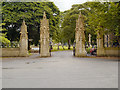
3
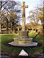
Cross of Sacrifice, Bury Cemetery
Bury cemetery was opened in 1869 and is owned by the council. A Cross of Sacrifice was erected facing the entrance after the end of the First World War. It is Grade II-listed (List Entry Number: 1451503 https://historicengland.org.uk/listing/the-list/list-entry/1451503 Historic England). The precise date of erection is unknown. It is first marked on the 1:2,500 Ordnance Survey (OS) map published in 1930. The town's main war memorial was erected in 1924 and it is likely that this memorial would have been raised at the same time. No extra inscriptions were added following the Second World War.
For information about the three headstones on the far side of the memorial, see Image
Image: © David Dixon
Taken: 17 May 2021
0.08 miles
4
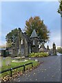
War Memorial at Bury Cemetery
Bury cemetery was opened in 1869 and is owned by the council. A Cross of Sacrifice was erected facing the entrance after the end of the First World War. It is Grade II-listed (List Entry Number: 1451503 https://historicengland.org.uk/listing/the-list/list-entry/1451503 Historic England).
According to the War Graves Commission https://www.cwgc.org/visit-us/find-cemeteries-memorials/cemetery-details/40913/Bury%20Cemetery,%20Redvales/ , there are now 87 First World War and 56 Second World War burials or commemorations in this site. The graves are scattered throughout the cemetery. The three headstones next to the memorial commemorate those buried in the churchyard at nearby St Peter’s Church. The inscription on the central stone reads:
1914 – 1918
1939 – 1945
THOSE HONOURED HERE
DIED IN THE SERVICE
OF THEIR COUNTRY
AND LIE BURIED IN
BURY (ST PAUL) CHURCHYARD
The stones to either side each carry seven names.
Image: © David Dixon
Taken: 17 May 2021
0.08 miles
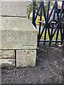
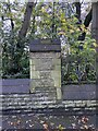
7
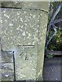
OS Cut Mark - Bury, Bury Cemetery Wall
https://www.bench-marks.org.uk/bm105596
Image: © thejackrustles
Taken: 3 Nov 2021
0.09 miles
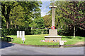
9
Location of OS Cut Mark - Bury, Bury Cemetery Wall
Image: © thejackrustles
Taken: 3 Nov 2021
0.10 miles