IMAGES TAKEN NEAR TO
White Carr Lane, BURY, BL9 6TE
Introduction
This page details the photographs taken nearby to White Carr Lane, BL9 6TE by members of the Geograph project.
The Geograph project started in 2005 with the aim of publishing, organising and preserving representative images for every square kilometre of Great Britain, Ireland and the Isle of Man.

There are currently over 7.5m images from over14,400 individuals and you can help contribute to the project by visiting https://www.geograph.org.uk
Image Map (15 Images)
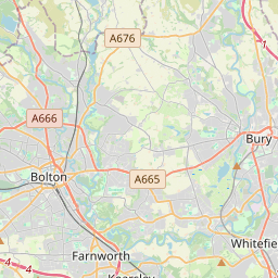
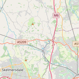

Leaflet Map data © OpenStreetMap
Images are licensed for reuse under creativecommons.org/licenses/by-sa/2.0
Notes
- Clicking on the map will re-center to the selected point.
- The higher the marker number, the further away the image location is from the centre of the postcode.
Image Listing (15 Images Found)
Images are licensed for reuse under creativecommons.org/licenses/by-sa/2.0
Image
Details
Distance
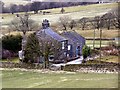
3
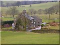
White Carr
This attractive country cottage lies just below the entrance to Walmesley Golf Club, amidst great views over the surrounding countryside.
Image: © Roger May
Taken: 27 Feb 2006
0.01 miles
7
Potatoes at Cob House Farm
These are imperfect ones which will be used to feed the cattle.
Image: © Bill Boaden
Taken: 3 May 2010
0.16 miles
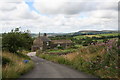
8
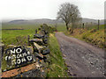
Scotland Lane
Scotland Lane, towards Dunham Farm.
Image: © David Dixon
Taken: 18 Feb 2011
0.19 miles
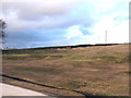
9
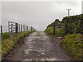
Track To Deep Moss
The track from the northern end of Scotland Lane, towards Deep Moss
Image: © David Dixon
Taken: 18 Feb 2011
0.19 miles
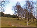
10
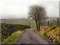
Track to Deep Moss
The track from the northern end of Scotland Lane, towards Deep Moss.
Image: © David Dixon
Taken: 18 Feb 2011
0.19 miles