IMAGES TAKEN NEAR TO
Moor Road, BURY, BL8 4NZ
Introduction
This page details the photographs taken nearby to Moor Road, BL8 4NZ by members of the Geograph project.
The Geograph project started in 2005 with the aim of publishing, organising and preserving representative images for every square kilometre of Great Britain, Ireland and the Isle of Man.

There are currently over 7.5m images from over14,400 individuals and you can help contribute to the project by visiting https://www.geograph.org.uk
Image Map
Images are licensed for reuse under creativecommons.org/licenses/by-sa/2.0
Notes
- Clicking on the map will re-center to the selected point.
- The higher the marker number, the further away the image location is from the centre of the postcode.
Image Listing (30 Images Found)
Images are licensed for reuse under creativecommons.org/licenses/by-sa/2.0
Image
Details
Distance
1
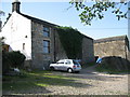
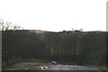
Chatterton Close Farm
This farm is located at the top of Image]
Image: © Paul Anderson
Taken: 11 Sep 2007
0.01 miles
2
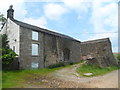
Chatterton Close Farm
The property is currently boarded up
Image: © Anthony Parkes
Taken: 1 Jun 2014
0.01 miles
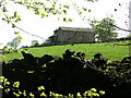
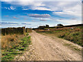
4
Private Road
This private road, that is also a public footpath, leads up to Chatteton Close Farm from Helmshore Road.
Image] is on top of the hill in the distance
Image: © Paul Anderson
Taken: 11 Sep 2007
0.04 miles
5
Chatterton Close
On White Hill, Holcombe Moor
Image: © David Long
Taken: 16 Feb 2006
0.05 miles
6
Moor Road, Holcombe Moor
Chatterton Close is in the trees.
Image: © Ian Taylor
Taken: 12 Sep 2018
0.09 miles
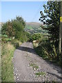
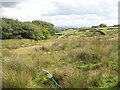
7
Bridleway on Holcombe Moor
This bridleway is marked as "Moor Road" on maps.
Image: © David Dixon
Taken: 24 Mar 2021
0.13 miles
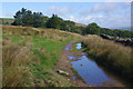
8
Road by Chatterton Close
A high level rough road running along the side of the Irwell valley.
Image: © Richard Webb
Taken: 30 Jul 2009
0.14 miles
9
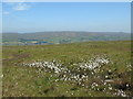
Across the cotton grass to Scout Moor
Taken between Pilgrim's Cross, Holcombe Moor, Greater Manchester, and White Hill, I am looking east across the cotton grass to Scout Moor Quarry and the wind farm straddling Scout Moor, Whittle Hill and Knowl Moor above.
Image: © Carroll Pierce
Taken: 7 Jun 2018
0.14 miles
10
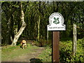
Footpath through Buckden Woods (west)
Buckden Woods is divided by Lumb Carr Road This is the west part just after the stile.
Owned by the National Trust, but not a public right of way.
Image: © liz dawson
Taken: 28 Apr 2007
0.16 miles