IMAGES TAKEN NEAR TO
Mizpah Grove, BURY, BL8 2SD
Introduction
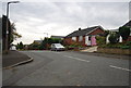
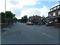
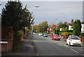
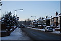
This page details the photographs taken nearby to Mizpah Grove, BL8 2SD by members of the Geograph project.
The Geograph project started in 2005 with the aim of publishing, organising and preserving representative images for every square kilometre of Great Britain, Ireland and the Isle of Man.

There are currently over 7.5m images from over14,400 individuals and you can help contribute to the project by visiting https://www.geograph.org.uk
Image Map
Images are licensed for reuse under creativecommons.org/licenses/by-sa/2.0
Notes
- Clicking on the map will re-center to the selected point.
- The higher the marker number, the further away the image location is from the centre of the postcode.
Image Listing (75 Images Found)
Images are licensed for reuse under creativecommons.org/licenses/by-sa/2.0
Image
Details
Distance
9
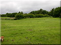
Grass near Parkers Lodges
There is a very nice field and footpath next to the lodges marked on the map.
A thick hawthorn hedge obscures the view of the water.
The mill buildings and chimney marked on the map have been demolished.
Image: © liz dawson
Taken: 17 Jun 2007
0.09 miles