IMAGES TAKEN NEAR TO
Victoria Street, BURY, BL8 2EQ
Introduction
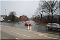
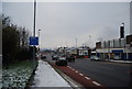
This page details the photographs taken nearby to Victoria Street, BL8 2EQ by members of the Geograph project.
The Geograph project started in 2005 with the aim of publishing, organising and preserving representative images for every square kilometre of Great Britain, Ireland and the Isle of Man.

There are currently over 7.5m images from over14,400 individuals and you can help contribute to the project by visiting https://www.geograph.org.uk
Image Map (Loading...)


Getting Data...Please wait
Leaflet Map data © OpenStreetMap
Images are licensed for reuse under creativecommons.org/licenses/by-sa/2.0
Notes
- Clicking on the map will re-center to the selected point.
- The higher the marker number, the further away the image location is from the centre of the postcode.
Image Listing (268 Images Found)
Images are licensed for reuse under creativecommons.org/licenses/by-sa/2.0
Image
Details
Distance
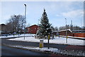
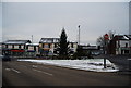
4

Christmas tree at the junction of Ainsworth Rd & Bolton Rd
Image: © N Chadwick
Taken: 20 Dec 2008
0.02 miles

9
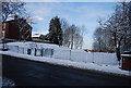
King George V playing fields entrance, Ainsworth Rd
Image: © N Chadwick
Taken: 18 Dec 2010
0.04 miles