IMAGES TAKEN NEAR TO
Sunningdale Close, BURY, BL8 2DG
Introduction
This page details the photographs taken nearby to Sunningdale Close, BL8 2DG by members of the Geograph project.
The Geograph project started in 2005 with the aim of publishing, organising and preserving representative images for every square kilometre of Great Britain, Ireland and the Isle of Man.

There are currently over 7.5m images from over14,400 individuals and you can help contribute to the project by visiting https://www.geograph.org.uk
Image Map
Images are licensed for reuse under creativecommons.org/licenses/by-sa/2.0
Notes
- Clicking on the map will re-center to the selected point.
- The higher the marker number, the further away the image location is from the centre of the postcode.
Image Listing (15 Images Found)
Images are licensed for reuse under creativecommons.org/licenses/by-sa/2.0
Image
Details
Distance
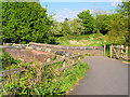
2
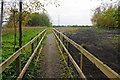
Diverted path past Lower Spen Moor Farm
There is no wandering off this path.
Image: © Bill Boaden
Taken: 19 May 2012
0.13 miles
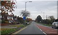
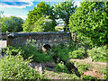
3
Bridge over former railway between Bury and Bolton
The bridge underneath has been filled in, and any path along the former track ends here. Further east the track bed has been developed as the Daisyfield Greenway, but it doesn't get this far. The housing beyond is part of the spread along the A58.
Image: © Bill Boaden
Taken: 19 May 2012
0.13 miles
4

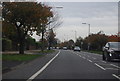
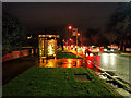
Early Christmas Lightshow on Bolton Road
Festive display outside a bungalow on Bolton Road; late November.
Image: © David Dixon
Taken: 26 Nov 2020
0.15 miles
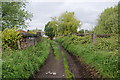
7
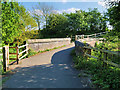
Bridge on Cyclepath near Elton Reservoir
The path runs from Buckingham Road to Mile Lane via Lower and Middle Spen Moor Farms. It crosses a small stream which drains into Elton Reservoir.
Image: © David Dixon
Taken: 4 May 2020
0.16 miles
8
Cycleway near Elton Reservoir
The path runs from Mile Lane to Buckingham Drive passing Middle and Lower Spen Moor Farms. This bridge crosses a stream which drains into Elton Reservoir.
Image: © David Dixon
Taken: 4 May 2020
0.16 miles
9
Bridge over Stream near Elton Reservoir
The bridge carries a path which runs from Buckingham Road to Mile Lane via Lower and Middle Spen Moor Farms. The stream drains into Elton Reservoir (behind the camera).
Image: © David Dixon
Taken: 11 May 2020
0.16 miles
10
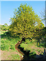
Stream and Tree on the North Side of Elton Reservoir
Stream draining into Elton Reservoir.
Image: © David Dixon
Taken: 4 May 2020
0.17 miles