IMAGES TAKEN NEAR TO
Woodhill Fold, BURY, BL8 1UY
Introduction
This page details the photographs taken nearby to Woodhill Fold, BL8 1UY by members of the Geograph project.
The Geograph project started in 2005 with the aim of publishing, organising and preserving representative images for every square kilometre of Great Britain, Ireland and the Isle of Man.

There are currently over 7.5m images from over14,400 individuals and you can help contribute to the project by visiting https://www.geograph.org.uk
Image Map
Images are licensed for reuse under creativecommons.org/licenses/by-sa/2.0
Notes
- Clicking on the map will re-center to the selected point.
- The higher the marker number, the further away the image location is from the centre of the postcode.
Image Listing (38 Images Found)
Images are licensed for reuse under creativecommons.org/licenses/by-sa/2.0
Image
Details
Distance
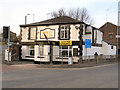
1
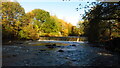
Bury - Weir on River Irwell off Woodhill Road
Image: © Colin Park
Taken: 13 Nov 2021
0.09 miles
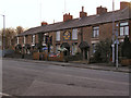
4
Bury's New Police Station
The old police station was in Irwell St. Image
Image: © N Chadwick
Taken: 18 Dec 2010
0.16 miles
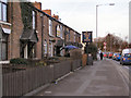
6
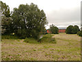
Landscaped Area
The landscaped area between the new police HQ on Dunster Road and the new fire station on Magdalene Road. The land is bounded on the other two sides by Castlecroft Road and Harvard Road.
Image: © David Dixon
Taken: 7 Sep 2012
0.18 miles
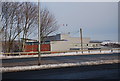
8
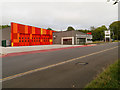
Bury Community Fire Station, Magdalene Road
The newly built fire station on Magdalene Road. The station was opened in July 2012, replacing the older station on The Rock (Image]).
The new £1.8 million community fire station, built by Kier Northern, has been awarded 'Excellent' BREEAM (Building Research Establishment Environmental Assessment Method) accreditation - making it one of the most environmentally sustainable buildings in Bury and one of the most energy efficient fire stations in the country (http://www.manchesterfire.gov.uk/updates/news/03july2012_new_bury_station.aspx Greater Manchester Fire and Rescue Service).
Image: © David Dixon
Taken: 7 Sep 2012
0.19 miles
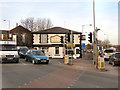
9
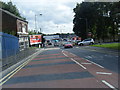
Dusty Miller
The Junction of Crostons Road and Tottington Road.
The direction post, partially hidden by the traffic light pole, is a grade II listed structure. It is dated 1834.
Image: © David Dixon
Taken: 16 Mar 2010
0.19 miles
10
Dusty Miller
The Junction of Crostons Road and Tottington Road.
The direction post, visible behind the blue car, is a grade II listed structure. It is dated 1834.
Image: © David Dixon
Taken: 16 Mar 2010
0.19 miles