IMAGES TAKEN NEAR TO
Plantation Road, BOLTON, BL7 0DD
Introduction
This page details the photographs taken nearby to Plantation Road, BL7 0DD by members of the Geograph project.
The Geograph project started in 2005 with the aim of publishing, organising and preserving representative images for every square kilometre of Great Britain, Ireland and the Isle of Man.

There are currently over 7.5m images from over14,400 individuals and you can help contribute to the project by visiting https://www.geograph.org.uk
Image Map
Images are licensed for reuse under creativecommons.org/licenses/by-sa/2.0
Notes
- Clicking on the map will re-center to the selected point.
- The higher the marker number, the further away the image location is from the centre of the postcode.
Image Listing (11 Images Found)
Images are licensed for reuse under creativecommons.org/licenses/by-sa/2.0
Image
Details
Distance
1
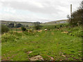
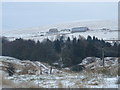
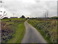
Edgworth Moor
Farmland off the end of Plantation Road
Image: © David Dixon
Taken: 3 Oct 2011
0.10 miles
2
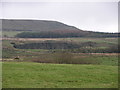
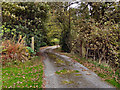
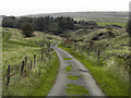
Plantation Road
Looking back from the track at the eastern end of Plantation Road.
Image: © David Dixon
Taken: 3 Oct 2011
0.13 miles
3
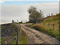
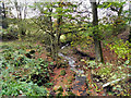
Track at the end of Plantation Road
The track from the end of Plantation Road, towards Redearth Farm
Image: © David Dixon
Taken: 3 Oct 2011
0.13 miles
4
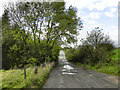
Track from Barons Farm
Looking towards Wickenlow Hill Farm (visible on the left of the photograph) and Plantation Road.
Image: © David Dixon
Taken: 3 Oct 2011
0.18 miles
5
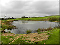
Track Towards Barons Farm
The path from Wickenlow Hill Farm towards Barons Farm.
Image: © David Dixon
Taken: 3 Oct 2011
0.18 miles