IMAGES TAKEN NEAR TO
Rotherhead Close, BOLTON, BL6 5UG
Introduction
This page details the photographs taken nearby to Rotherhead Close, BL6 5UG by members of the Geograph project.
The Geograph project started in 2005 with the aim of publishing, organising and preserving representative images for every square kilometre of Great Britain, Ireland and the Isle of Man.

There are currently over 7.5m images from over14,400 individuals and you can help contribute to the project by visiting https://www.geograph.org.uk
Image Map (Loading...)


Getting Data...Please wait
Leaflet Map data © OpenStreetMap
Images are licensed for reuse under creativecommons.org/licenses/by-sa/2.0
Notes
- Clicking on the map will re-center to the selected point.
- The higher the marker number, the further away the image location is from the centre of the postcode.
Image Listing (5 Images Found)
Images are licensed for reuse under creativecommons.org/licenses/by-sa/2.0
Image
Details
Distance
3
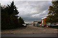
The B5238 to Horwich with Rivington Pike in the background
Image: © Ian Greig
Taken: 29 Oct 2010
0.17 miles
5
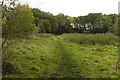
A clearing in the woods near Gibb Farm
Image: © Mark Anderson
Taken: 21 Oct 2018
0.23 miles