IMAGES TAKEN NEAR TO
Rosewood, BOLTON, BL5 2RX
Introduction
This page details the photographs taken nearby to Rosewood, BL5 2RX by members of the Geograph project.
The Geograph project started in 2005 with the aim of publishing, organising and preserving representative images for every square kilometre of Great Britain, Ireland and the Isle of Man.

There are currently over 7.5m images from over14,400 individuals and you can help contribute to the project by visiting https://www.geograph.org.uk
Image Map (Loading...)


Getting Data...Please wait
Leaflet Map data © OpenStreetMap
Images are licensed for reuse under creativecommons.org/licenses/by-sa/2.0
Notes
- Clicking on the map will re-center to the selected point.
- The higher the marker number, the further away the image location is from the centre of the postcode.
Image Listing (17 Images Found)
Images are licensed for reuse under creativecommons.org/licenses/by-sa/2.0
Image
Details
Distance
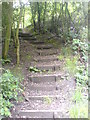
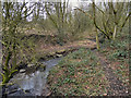
2
Cunningham Clough
Cunningham Clough runs along part of Cunningham Brook; This area to the west of Wearish road is mostly scrub and woodland.
Image: © David Dixon
Taken: 15 Feb 2012
0.11 miles
3
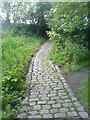
Cobbled Path In Cunningham Clough
Cunningham Clough runs along part of Cunningham Brook; The area to the west of Wearish road is mostly scrub and woodland. This is the cobbled path which leads down to the brook, from Wearish Road.
Image: © David Dixon
Taken: 15 Feb 2012
0.11 miles
4

Bridge Over Cunningham Brook
The metal footbridge taking the path over Cunningham Brook, in Cunningham Clough.
Image: © David Dixon
Taken: 15 Feb 2012
0.12 miles
5
Cunningham Brook
Cunningham Brook running through Cunningham Clough, between Hart Common and Daisy Hill.
Image: © David Dixon
Taken: 15 Feb 2012
0.12 miles
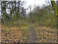
6
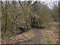
Footpath Through Cunningham Clough
Cunningham Clough runs along part of Cunningham Brook. The area to the west of Wearish road is mostly scrub and woodland, this is the footpath from Bank's Farm, leading to the metal footbridge across the brook and then through the other side of the clough, to Wearish Road.
Image: © David Dixon
Taken: 15 Feb 2012
0.13 miles
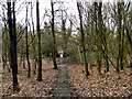
7
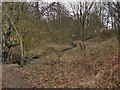
Cunningham Clough
Cunningham Clough runs along part of Cunningham Brook. This area to the west of Wearish road is mostly scrub and woodland.
Image: © David Dixon
Taken: 15 Feb 2012
0.14 miles
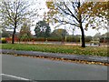
9
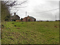
Bank's Farm
Looking towards Banks's Farm from the edge of Cunningham Clough.
Image: © David Dixon
Taken: 15 Feb 2012
0.17 miles