IMAGES TAKEN NEAR TO
Parr Close, BOLTON, BL4 0DF
Introduction
This page details the photographs taken nearby to Parr Close, BL4 0DF by members of the Geograph project.
The Geograph project started in 2005 with the aim of publishing, organising and preserving representative images for every square kilometre of Great Britain, Ireland and the Isle of Man.

There are currently over 7.5m images from over14,400 individuals and you can help contribute to the project by visiting https://www.geograph.org.uk
Image Map
Images are licensed for reuse under creativecommons.org/licenses/by-sa/2.0
Notes
- Clicking on the map will re-center to the selected point.
- The higher the marker number, the further away the image location is from the centre of the postcode.
Image Listing (13 Images Found)
Images are licensed for reuse under creativecommons.org/licenses/by-sa/2.0
Image
Details
Distance
1
St George with St James, New Bury
On the edge of the Flower Estate, being situated on the corner of Daisy Avenue.
Image: © Bill Boaden
Taken: 7 Sep 2015
0.02 miles
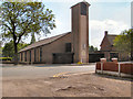
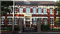
2
St George's Church and Centre
Plodder Lane, Farnworth.
Image: © David Dixon
Taken: 22 May 2010
0.02 miles
4
Our Lady of Lourdes & St Gregory's Parish Church
Plodder Lane, Farworth
Image: © David Dixon
Taken: 22 May 2010
0.10 miles
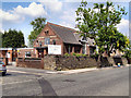
5
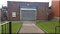
Our Lady of Lourdes social club
The building is on Plodder Lane, adjacent to Our Lady of Lourdes & St Gregory's Parish.
Image: © Bradley Michael
Taken: 4 Sep 2015
0.13 miles
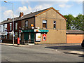
6
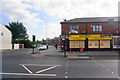
Corner shop on Plodder Lane
On the corner of Laburnum Road and Plodder Lane.
Image: © Bill Boaden
Taken: 7 Sep 2015
0.15 miles
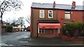
8
Flower Estate Off Licence
The estate is so named because many roads are named after flowers. This shop is on Daffodil Road.
Image: © Bill Boaden
Taken: 7 Sep 2015
0.17 miles
9
Former butcher's shop, Highfield Road
Image: © Bradley Michael
Taken: 31 Dec 2015
0.18 miles
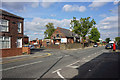
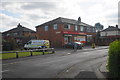
10
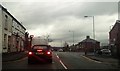
Junction at the end of Marsh Lane
Marsh Lane (near) continues onto Bradford Road and Plodder Lane is left and right. This is the busiest junction in Image, Bradford Road is a route to Bolton and Plodder Lane (B6199) links Farnworth and the M61.
Image: © Bradley Michael
Taken: 22 Dec 2015
0.18 miles