IMAGES TAKEN NEAR TO
Tottington Road, BOLTON, BL2 4LJ
Introduction
This page details the photographs taken nearby to Tottington Road, BL2 4LJ by members of the Geograph project.
The Geograph project started in 2005 with the aim of publishing, organising and preserving representative images for every square kilometre of Great Britain, Ireland and the Isle of Man.

There are currently over 7.5m images from over14,400 individuals and you can help contribute to the project by visiting https://www.geograph.org.uk
Image Map
Images are licensed for reuse under creativecommons.org/licenses/by-sa/2.0
Notes
- Clicking on the map will re-center to the selected point.
- The higher the marker number, the further away the image location is from the centre of the postcode.
Image Listing (13 Images Found)
Images are licensed for reuse under creativecommons.org/licenses/by-sa/2.0
Image
Details
Distance
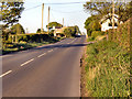
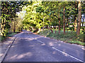
3
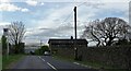
Tottington Road
With Winter Hill in the background.
Image: © philandju
Taken: 22 Apr 2022
0.10 miles
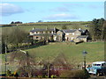
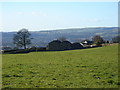
5
Tottington Road
Hillside Farm on the right, Top of Raikes on the left.
Image: © David Dixon
Taken: 17 May 2010
0.14 miles
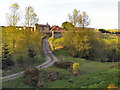
6
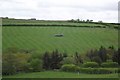
That dratted satnav again
Lorry looking lost in the middle of a meadow.
Image: © philandju
Taken: 22 May 2013
0.14 miles
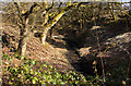
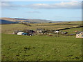
10
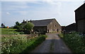
Bowstone Hill Farm
A fine barn straight ahead.
Image: © Bill Boaden
Taken: 5 Jun 2010
0.22 miles