IMAGES TAKEN NEAR TO
Queens Park Walk, BL1 4GS

Introduction

This page details the photographs taken nearby to Queens Park Walk, BL1 4GS by members of the Geograph project.

The Geograph project started in 2005 with the aim of publishing, organising and preserving representative images for every square kilometre of Great Britain, Ireland and the Isle of Man.

There are currently over 7.5m images from over14,400 individuals and you can help contribute to the project by visiting https://www.geograph.org.uk

Image Map


Images are licensed for reuse under creativecommons.org/licenses/by-sa/2.0
Notes
  • Clicking on the map will re-center to the selected point.
  • The higher the marker number, the further away the image location is from the centre of the postcode.

Image Listing (85 Images Found)

Images are licensed for reuse under creativecommons.org/licenses/by-sa/2.0
  • ...
Image
Details
Distance
1
Another weir on the River Croal
West of Bolton Town Centre
Image: © Gary Rogers Taken: 18 Feb 2019
0.05 miles
2
Old Arches in the River Croal
Where the River Croal disappears underground at the bridge on White Lion Brow
Image: © Gary Rogers Taken: 18 Feb 2019
0.07 miles
3
Spa Mill
Spa Road, Bolton
Image: © David Dixon Taken: 30 May 2010
0.09 miles
4
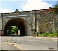
Bridge over St Helena Road
The bridge which carries Marsland Road over St Helena Road is Grade II listed https://historicengland.org.uk/listing/the-list/list-entry/1388115 It dates from 1890 and has a wide arch built on an angle forming a 'skew' bridge. It seems to have been much reinforced over the years.
Image: © Gerald England Taken: 19 May 2018
0.11 miles
5
Road bridge
The bridge carries Marsden Road over St. Helena Road.
Image: © philandju Taken: 13 Jun 2018
0.11 miles
6
Bolton Corporation's first power station
The Corporation's first electricity power station in Spa Road was opened by Alderman John Miles J.P. in 1894.
Image: © philandju Taken: 26 Jun 2018
0.11 miles
7
Former school and workshop for the blind
The building, dating from 1867, now houses a skills and employment advice centre together with other advice and social help bodies.
Image: © philandju Taken: 17 May 2022
0.12 miles
8
Low bridge over Bark Street
The bridge carries Marsland Road over Bark Street. It was erected in 1876 as detailed in a commemorative plaque Image on the bridge. It has a height restriction of 3.9m / 12' 9".
Image: © Gerald England Taken: 19 May 2018
0.12 miles
9
Charles Wolfenden plaque on bridge
Lord Mayor of Bolton 1875-77
Image: © Mrs W J Sutherland Taken: 30 Jun 2024
0.12 miles
10
Deans Gate, Bolton
The Bolton Evening News is for sale
Image: © Kenneth Allen Taken: 22 Sep 2008
0.12 miles
  • ...