IMAGES TAKEN NEAR TO
Burnley Road, BURY, BL0 0HX
Introduction
This page details the photographs taken nearby to Burnley Road, BL0 0HX by members of the Geograph project.
The Geograph project started in 2005 with the aim of publishing, organising and preserving representative images for every square kilometre of Great Britain, Ireland and the Isle of Man.

There are currently over 7.5m images from over14,400 individuals and you can help contribute to the project by visiting https://www.geograph.org.uk
Image Map
Images are licensed for reuse under creativecommons.org/licenses/by-sa/2.0
Notes
- Clicking on the map will re-center to the selected point.
- The higher the marker number, the further away the image location is from the centre of the postcode.
Image Listing (45 Images Found)
Images are licensed for reuse under creativecommons.org/licenses/by-sa/2.0
Image
Details
Distance
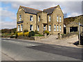
1
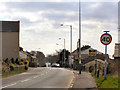
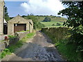
Burnley Road
Looking towards Edenfield.
Image: © David Dixon
Taken: 15 Apr 2010
0.01 miles
6
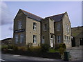
No 114, Bury Road
The name Quarrymans Inn is cast in concrete, so there could be problems taking the name down.
Image: © Alexander P Kapp
Taken: 18 Sep 2008
0.06 miles
7
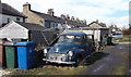
Morris Traveller, Back Burnley Road, Edenfield
Image: © Robert Wade
Taken: 14 Mar 2011
0.06 miles
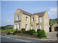
8
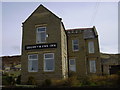
Quarrymans Inn
Former public house, now appears to be used as a private dwelling.
Image: © David Dixon
Taken: 15 Apr 2010
0.06 miles
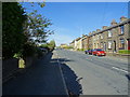
9
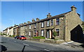
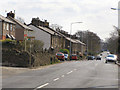
Terraced housing on Burnley Road, Edenfield
Image: © JThomas
Taken: 25 Sep 2018
0.07 miles