IMAGES TAKEN NEAR TO
Ruth Street, BURY, BL0 0HA
Introduction
This page details the photographs taken nearby to Ruth Street, BL0 0HA by members of the Geograph project.
The Geograph project started in 2005 with the aim of publishing, organising and preserving representative images for every square kilometre of Great Britain, Ireland and the Isle of Man.

There are currently over 7.5m images from over14,400 individuals and you can help contribute to the project by visiting https://www.geograph.org.uk
Image Map (Loading...)


Getting Data...Please wait
Leaflet Map data © OpenStreetMap
Images are licensed for reuse under creativecommons.org/licenses/by-sa/2.0
Notes
- Clicking on the map will re-center to the selected point.
- The higher the marker number, the further away the image location is from the centre of the postcode.
Image Listing (104 Images Found)
Images are licensed for reuse under creativecommons.org/licenses/by-sa/2.0
Image
Details
Distance
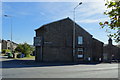
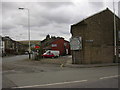
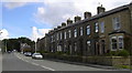
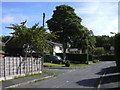
1
Bolton Road North, Edenfield
Looking south west.
Image: © JThomas
Taken: 25 Sep 2018
0.01 miles
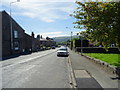
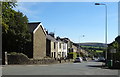
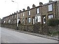
2
Houses on the junction of Bolton Road North and Bury Road
Image: © JThomas
Taken: 25 Sep 2018
0.01 miles
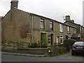
4
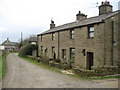
Eden Street Edenfield
These semi detached cottages in Edenfield are located on Eden Street.
The track to the left of the picture takes you down to Image which is approximately 400 yards away.
Image: © Paul Anderson
Taken: 13 Mar 2007
0.02 miles
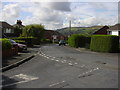
10
Bury Road Edenfield
Edenfield shared in the textile boom of the 18th and 19th centuries, but also has a long farming tradition. This continues today, with open farmland only a few minutes’ walk from the cottage homes in the village.
Most of the mills in the area have now been demolished or converted to other uses.
Much of the land in the area is in the ownership of the National Trust, the result of a bequest by the Porritt family in memory of Richard Porritt, the first Member of Parliament to be killed in action during the Second World War, and many attractive footpaths traverse this area, including a section of the 45-mile Rossendale Way long-distance footpath.
Image: © Paul Anderson
Taken: 19 Mar 2007
0.06 miles