
IMAGES TAKEN NEAR TO
Cucklington Gardens, BOURNEMOUTH, BH9 3QS
Introduction
This page details the photographs taken nearby to Cucklington Gardens, BH9 3QS by members of the Geograph project.
The Geograph project started in 2005 with the aim of publishing, organising and preserving representative images for every square kilometre of Great Britain, Ireland and the Isle of Man.

There are currently over 7.5m images from over14,400 individuals and you can help contribute to the project by visiting https://www.geograph.org.uk
Image Map
Images are licensed for reuse under creativecommons.org/licenses/by-sa/2.0
Notes
- Clicking on the map will re-center to the selected point.
- The higher the marker number, the further away the image location is from the centre of the postcode.
Image Listing (22 Images Found)
Images are licensed for reuse under creativecommons.org/licenses/by-sa/2.0
Image
Details
Distance
1
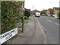
Thorncombe Close, Muscliffe, Bournemouth
Image: © Alex McGregor
Taken: 18 Oct 2010
0.10 miles
2
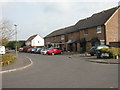
Muscliff, Boveridge Gardens
Muscliff has a mix of different types of housing, mostly owner-occupied; here, semi-detached. Most local roads are named after rural towns & villages in Dorset.
Image: © Mike Faherty
Taken: 1 Mar 2009
0.11 miles
3
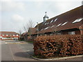
Muscliff, medical centre
Large, grand-looking medical centre in the neighbourhood centre; formally, James Fisher Medical Centre http://www.jfmc.co.uk/
Image: © Mike Faherty
Taken: 1 Mar 2009
0.11 miles
4
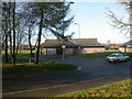
Muscliffe Community Centre
Operated by Bournemouth Council, used by groups as diverse as Coeliac UK, Ramblers & Age Concern, and no doubt many more. In the background, playing fields; to the right, youth centre. http://www.bournemouth.gov.uk/Residents/Community/Community_Development/centres.asp
Image: © Mike Faherty
Taken: 9 Dec 2008
0.12 miles
5
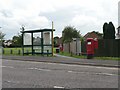
Muscliff: postbox № BH9 398, Shillingstone Drive
Shillingstone Drive is the main road through this 80s housing estate; it doesn't contain any houses itself but provides access to all the side roads. The postbox and bus shelter shown here stand opposite a convenience store, and in front of one of many grassed open spaces between the houses. The tower of the Image can be discerned through the central window of the bus shelter.
Image: © Chris Downer
Taken: 17 Aug 2008
0.13 miles
6
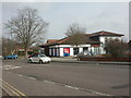
Muscliff, Tesco Express
On Shillingstone Drive; for information, seehttp://www.tesco.com/storelocator/access/details.asp?bID=5027&l=B
Image: © Mike Faherty
Taken: 1 Mar 2009
0.14 miles
7
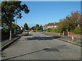
Street Scene, Throop
Throop is a suburb of Bournemouth.
Image: © Stuart Buchan
Taken: 13 Oct 2005
0.16 miles
8
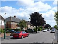
Larksfield Avenue, Bournemouth
View south east along this street in the heart of residential Bournemouth.
Image: © Nigel Mykura
Taken: 28 Aug 2009
0.18 miles
9
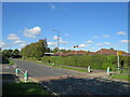
Shillingstone Drive, Muscliff, Bournemouth
Shillingstone Drive is a minor road in Muscliff, a suburb of Bournemouth. Here, the road passes a school. Mannequins either side of the road provide a reminder to drivers to slow down and keep an eye out for children.
Image: © Malc McDonald
Taken: 5 Oct 2024
0.19 miles
10
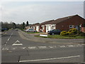
Muscliff, bungalows
Modern bungalows in Sturminster Road; local roads all seem to be named after Dorset rural towns or villages.
Image: © Mike Faherty
Taken: 1 Mar 2009
0.19 miles