
IMAGES TAKEN NEAR TO
Horton Close, BOURNEMOUTH, BH9 3PH
Introduction
This page details the photographs taken nearby to Horton Close, BH9 3PH by members of the Geograph project.
The Geograph project started in 2005 with the aim of publishing, organising and preserving representative images for every square kilometre of Great Britain, Ireland and the Isle of Man.

There are currently over 7.5m images from over14,400 individuals and you can help contribute to the project by visiting https://www.geograph.org.uk
Image Map
Images are licensed for reuse under creativecommons.org/licenses/by-sa/2.0
Notes
- Clicking on the map will re-center to the selected point.
- The higher the marker number, the further away the image location is from the centre of the postcode.
Image Listing (46 Images Found)
Images are licensed for reuse under creativecommons.org/licenses/by-sa/2.0
Image
Details
Distance
1
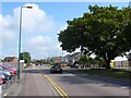
Broadway Lane Bournemouth
Looking NE up the lane from Broadway Roundabout
Image: © Nigel Mykura
Taken: 13 Sep 2008
0.12 miles
2
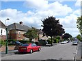
Larksfield Avenue, Bournemouth
View south east along this street in the heart of residential Bournemouth.
Image: © Nigel Mykura
Taken: 28 Aug 2009
0.13 miles
3
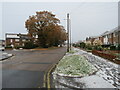
Autumn trees and winter snow in Muscliff, Bournemouth
This image shows Broadway Lane in Muscliff, on the northern outskirts of Bournemouth. It was taken on a very cold December day. The trees had not yet finished shedding their leaves, but there had been a dusting of snow overnight.
Image: © Malc McDonald
Taken: 11 Dec 2022
0.13 miles
4
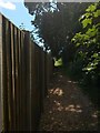
Muscliff: southern segment of footpath K24
This public footpath is a historical route, known as Barrowgate Road, which long pre-dates the 1980s Muscliff housing estate. Despite now running between the back gardens of houses on the estate, it retains its rural feel.
This southern segment is the narrowest, hemmed in between the back fence of Rownhams Road houses, and the hedges at the back of the older Harbeck Road properties.
See Image for the next view on the path ahead, and Image for the next view behind us - with links to further photos all along the route.
Image: © Chris Downer
Taken: 16 Jul 2016
0.13 miles
5
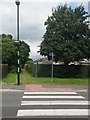
Muscliff: footpath K24 from Chesildene Drive
This public footpath is a historical route, known as Barrowgate Road, which long pre-dates the 1980s Muscliff housing estate. Despite now running between the back gardens of houses on the estate, it retains its rural feel.
We look at it here from its southern end, on Chesildene Drive, one of the main roads through the estate. Its entrance coincides, rather helpfully, with a zebra crossing.
See Image for the next view on the path ahead, and links to further photos all along the route.
Image: © Chris Downer
Taken: 16 Jul 2016
0.13 miles
6
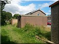
Muscliff: Rownhams Road garages back onto footpath K24
This public footpath is a historical route, known as Barrowgate Road, which long pre-dates the 1980s Muscliff housing estate. Despite now running between the back gardens of houses on the estate, it retains its rural feel.
Here, we pass one of two little cut-throughs to Rownhams Road, via garage concourses off the main carriageway.
See Image for the next view on the path ahead, and Image for the next view behind us - each with links to further photos all along the route.
Image: © Chris Downer
Taken: 16 Jul 2016
0.15 miles
7
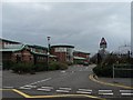
Throop: Muscliff Primary School
The school was opened in the mid-1990s to answer the needs of this rapidly growing housing estates and is now one of the most oversubscribed primary schools in Bournemouth.
Image: © Chris Downer
Taken: 3 Feb 2008
0.15 miles
8
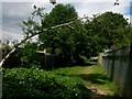
Muscliff: holly branch over footpath K24
This public footpath is a historical route, known as Barrowgate Road, which long pre-dates the 1980s Muscliff housing estate. Despite now running between the back gardens of houses on the estate, it retains its rural feel.
It can be seen here heading north, with the backs of houses in Rownhams Road to the right.
See Image for the next view on the path ahead, and Image for the next view behind us - each with links to further photos all along the route.
Image: © Chris Downer
Taken: 16 Jul 2016
0.16 miles
9
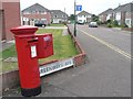
Throop: postbox № BH8 208, Broadway Lane
A magnet for graffiti like many postboxes, this one is in Broadway Lane, on the corner of Greenways Avenue.
Image: © Chris Downer
Taken: 18 Jul 2008
0.17 miles
10
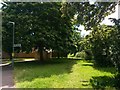
Muscliff: footpath K24 south from Ashurst Road
This public footpath is a historical route, known as Barrowgate Road, which long pre-dates the 1980s Muscliff housing estate. Despite now running between the back gardens of houses on the estate, it retains its rural feel.
It can be seen here heading south from Ashurst Road, an extension of the path behind us to Careys Road.
See Image for the next view on the path ahead, and Image for the next view behind us - each with links to further photos all along the route.
Image: © Chris Downer
Taken: 16 Jul 2016
0.17 miles