1
Stour Valley Nature Reserve
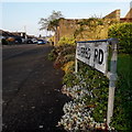
This is the entrance to the reserve with the information board in the foreground.
Image: © Stuart Buchan
Taken: 13 Oct 2005
0.01 miles
2
Bournemouth : Muscliff - Muscliffe Lane
Muscliffe Lane at 3.20pm on a February afternoon.
Image: © Lewis Clarke
Taken: 11 Feb 2010
0.05 miles
3
Muscliffe Lane, Muscliff, Bournemouth
Muscliffe Lane is a residential road in the northern outskirts of Bournemouth. It is in a district named Muscliff, some maps spell this Muscliffe (note the additional 'e' at the end)
Image: © Malc McDonald
Taken: 5 Oct 2024
0.05 miles
4
Bournemouth : Muscliff - Cox Avenue
Cox Avenue at the road junction with Muscliffe Lane.
Image: © Lewis Clarke
Taken: 11 Feb 2010
0.06 miles
5
Bournemouth : Muscliffe Road & Strathmore Road junction
A road junction between the two roads in the north of Bournemouth.
Image: © Lewis Clarke
Taken: 6 Jun 2008
0.07 miles
6
Redhill: Edifred Road
Looking southwest along Edifred Road from Granby Road. Both feature bungalows but those at this end of Granby Road, alongside one of which we are standing, do not have garden fences.
The sign is the standard Bournemouth nameplate from the 1980s, affixed with tubular steel which protrudes at each side.
This is photo no.124 of a series of 453 in my coronavirus lockdown walking project:
See https://www.geograph.org.uk/article/My-2020-Coronavirus-Lockdown-walking-project for the complete set of photos.
Image: © Chris Downer
Taken: 12 Apr 2020
0.08 miles
7
Bournemouth : Muscliff - Muscliffe Lane
Muscliffe Lane taken on the junction with Strathmore Road.
Image: © Lewis Clarke
Taken: 11 Feb 2010
0.10 miles
8
Granby Avenue, Muscliffe
A residential road off Muscliffe Avenue.
Image: © Derek Harper
Taken: 13 Oct 2009
0.10 miles
9
Muscliff: Newmorton Road
Part of a small development of bungalows on this western side of Muscliffe Lane.
The slightly leaning sign is the standard Bournemouth nameplate from the 1980s, affixed with tubular steel which protrudes at each side.
This is photo no.291 of a series of 453 in my coronavirus lockdown walking project:
See https://www.geograph.org.uk/article/My-2020-Coronavirus-Lockdown-walking-project for the complete set of photos.
Image: © Chris Downer
Taken: 10 Apr 2020
0.11 miles
10
Muscliff: footpath M15 from Granby Road
Looking across the eastern end of Granby Road, close to the visitor centre car park, at the start of this long public footpath to Throop via the Stour Valley Way.
This is the last photo in a series of 43 along the length of public footpath M15, Bournemouth's longest public right of way and the only one over 2km in length. It forms part of the Stour Valley Way long-distance path, although it doesn't see all that much of the Stour. It consists of a tarmacked lane at the Throop end and a good quality gravel path for the majority of its course - it has been improved in the last few years to make it wheelchair accessible and a shared route for cyclists. See
Image for the previous photo and links to the other photos all along the route.
Image: © Chris Downer
Taken: 16 Jul 2016
0.11 miles


