
IMAGES TAKEN NEAR TO
Muscliffe Lane, BOURNEMOUTH, BH9 3NF
Introduction
This page details the photographs taken nearby to Muscliffe Lane, BH9 3NF by members of the Geograph project.
The Geograph project started in 2005 with the aim of publishing, organising and preserving representative images for every square kilometre of Great Britain, Ireland and the Isle of Man.

There are currently over 7.5m images from over14,400 individuals and you can help contribute to the project by visiting https://www.geograph.org.uk
Image Map
Images are licensed for reuse under creativecommons.org/licenses/by-sa/2.0
Notes
- Clicking on the map will re-center to the selected point.
- The higher the marker number, the further away the image location is from the centre of the postcode.
Image Listing (97 Images Found)
Images are licensed for reuse under creativecommons.org/licenses/by-sa/2.0
Image
Details
Distance
1
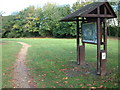
Stour Valley Nature Reserve
This is the entrance to the reserve with the information board in the foreground.
Image: © Stuart Buchan
Taken: 13 Oct 2005
0.04 miles
2
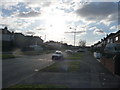
Bournemouth : Muscliff - Muscliffe Lane
Muscliffe Lane at 3.20pm on a February afternoon.
Image: © Lewis Clarke
Taken: 11 Feb 2010
0.04 miles
3
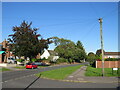
Muscliffe Lane, Muscliff, Bournemouth
Muscliffe Lane is a residential road in the northern outskirts of Bournemouth. It is in a district named Muscliff, some maps spell this Muscliffe (note the additional 'e' at the end)
Image: © Malc McDonald
Taken: 5 Oct 2024
0.04 miles
4
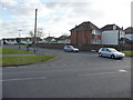
Bournemouth : Muscliff - Cox Avenue
Cox Avenue at the road junction with Muscliffe Lane.
Image: © Lewis Clarke
Taken: 11 Feb 2010
0.05 miles
5
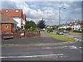
Bournemouth : Muscliffe Road & Strathmore Road junction
A road junction between the two roads in the north of Bournemouth.
Image: © Lewis Clarke
Taken: 6 Jun 2008
0.06 miles
6
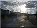
Bournemouth : Muscliff - Muscliffe Lane
Muscliffe Lane taken on the junction with Strathmore Road.
Image: © Lewis Clarke
Taken: 11 Feb 2010
0.09 miles
7
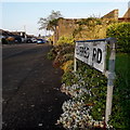
Redhill: Edifred Road
Looking southwest along Edifred Road from Granby Road. Both feature bungalows but those at this end of Granby Road, alongside one of which we are standing, do not have garden fences.
The sign is the standard Bournemouth nameplate from the 1980s, affixed with tubular steel which protrudes at each side.
This is photo no.124 of a series of 453 in my coronavirus lockdown walking project:
See https://www.geograph.org.uk/article/My-2020-Coronavirus-Lockdown-walking-project for the complete set of photos.
Image: © Chris Downer
Taken: 12 Apr 2020
0.09 miles
8
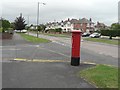
Muscliff: postbox № BH9 263, Muscliffe Lane
Here, we look northeast along Muscliffe Lane, past this George VI-reign postbox on the corner of Strathmore Road.
Image: © Chris Downer
Taken: 18 Jul 2008
0.10 miles
9
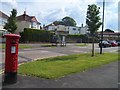
Bournemouth : Muscliffe Lane & Postbox
A postbox and bus stop on Muscliffe Lane
Image: © Lewis Clarke
Taken: 6 Jun 2008
0.10 miles
10
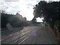
Bournemouth : Muscliff - Muscliff Lane
The lane which heads towards Castle Lane.
Image: © Lewis Clarke
Taken: 11 Feb 2010
0.11 miles