
IMAGES TAKEN NEAR TO
West Way, BOURNEMOUTH, BH9 3DX
Introduction
This page details the photographs taken nearby to West Way, BH9 3DX by members of the Geograph project.
The Geograph project started in 2005 with the aim of publishing, organising and preserving representative images for every square kilometre of Great Britain, Ireland and the Isle of Man.

There are currently over 7.5m images from over14,400 individuals and you can help contribute to the project by visiting https://www.geograph.org.uk
Image Map
Images are licensed for reuse under creativecommons.org/licenses/by-sa/2.0
Notes
- Clicking on the map will re-center to the selected point.
- The higher the marker number, the further away the image location is from the centre of the postcode.
Image Listing (50 Images Found)
Images are licensed for reuse under creativecommons.org/licenses/by-sa/2.0
Image
Details
Distance
1
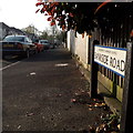
Moordown: Bankside Road
Bankside Road is a short road among desirable detached housing. It is at the very limit of my 2km radius - the first parked car is probably beyond the circle!
The sign is a modern one, dating from the second half of the 2010s decade. The Council has ditched the borough logo and now just has BOURNEMOUTH BOROUGH COUNCIL in plain wording. The logo, in green, blue and yellow, had been susceptible to fading.
This is photo no.26 of a series of 451 in my coronavirus lockdown walking project:
See https://www.geograph.org.uk/article/My-2020-Coronavirus-Lockdown-walking-project for the complete set of photos.
Image: © Chris Downer
Taken: 12 Apr 2020
0.07 miles
2
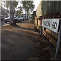
Moordown: Franklin Road
A short road of detached houses – just four or five on each side – in an area almost all made up of these decent, early 20th century houses.
The sign is the standard Bournemouth nameplate from the 1980s, affixed with tubular steel which protrudes at each side.
This is photo no.149 of a series of 453 in my coronavirus lockdown walking project:
See https://www.geograph.org.uk/article/My-2020-Coronavirus-Lockdown-walking-project for the complete set of photos.
Image: © Chris Downer
Taken: 12 Apr 2020
0.08 miles
3
Bournemouth : BP Petrol Station & Somerfield Shop
Image: © Lewis Clarke
Taken: 27 Apr 2009
0.08 miles
4
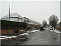
Winter weather in Charminster, Bournemouth
A wintry scene on Huntvale Road in Charminster, in the northern suburbs of Bournemouth.
This image was taken during a cold snap in December 2022. A dusting of snow had fallen overnight. It was turning to slush on the road surface as cars drove over it.
Image: © Malc McDonald
Taken: 11 Dec 2022
0.09 miles
5
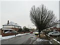
Winter weather in Charminster, Bournemouth
A wintry scene on Haverstock Road in Charminster, in the northern suburbs of Bournemouth.
This image was taken during a cold snap in December 2022. A dusting of snow had fallen overnight. It had turned to slush on the road surface and begun to melt away as cars had driven over it. Contrasting with the wintry conditions, autumn leaves which had only recently fallen can be seen beneath the tree.
Image: © Malc McDonald
Taken: 11 Dec 2022
0.09 miles
6
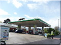
Bournemouth : BP Petrol Station & Somerfield Shop
Image: © Lewis Clarke
Taken: 27 Apr 2009
0.09 miles
7
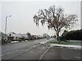
Winter weather on Castle Lane West, Charminster, Bournemouth
A wintry scene on Castle Lane West in Charminster, in the northern suburbs of Bournemouth. Castle Lane West forms part of the A3060 passing through Bournemouth's northern outskirts.
This image was taken during a cold snap in December 2022. A dusting of snow had fallen overnight. The surface of the main road was clear, it may have been gritted to keep it safe for passing traffic.
Image: © Malc McDonald
Taken: 11 Dec 2022
0.11 miles
8
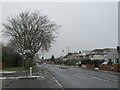
Castle Lane West, Charminster, Bournemouth
A wintry scene on Castle Lane West in Charminster, in the northern suburbs of Bournemouth. Castle Lane West is on the route of the A3060 passing through Bournemouth's northern outskirts.
This image was taken during a cold snap in December 2022. A dusting of snow had fallen overnight. The road surface was clear, it may have been gritted to keep it safe for passing traffic.
Image: © Malc McDonald
Taken: 11 Dec 2022
0.11 miles
9
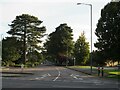
West Way, Bournemouth
West Way is a tree-lined minor road in the northern suburbs of Bournemouth.
Image: © Malc McDonald
Taken: 5 Oct 2024
0.12 miles
10
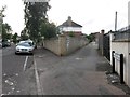
Moordown: Priory View Place from Priory View Road
Priory View Place is essentially a rear access lane to shops on Castle Lane West, between Priory View Road and Redbreast Road North, but it does have a couple of residential properties along it. It also forms public footpath M12.
We see it here running off Priory View Road at an acute angle.
See Image for the next view along the lane, and links to further views along the route.
Image: © Chris Downer
Taken: 10 Jul 2016
0.12 miles