
IMAGES TAKEN NEAR TO
Malvern Road, BOURNEMOUTH, BH9 3AH
Introduction
This page details the photographs taken nearby to Malvern Road, BH9 3AH by members of the Geograph project.
The Geograph project started in 2005 with the aim of publishing, organising and preserving representative images for every square kilometre of Great Britain, Ireland and the Isle of Man.

There are currently over 7.5m images from over14,400 individuals and you can help contribute to the project by visiting https://www.geograph.org.uk
Image Map
Images are licensed for reuse under creativecommons.org/licenses/by-sa/2.0
Notes
- Clicking on the map will re-center to the selected point.
- The higher the marker number, the further away the image location is from the centre of the postcode.
Image Listing (86 Images Found)
Images are licensed for reuse under creativecommons.org/licenses/by-sa/2.0
Image
Details
Distance
1
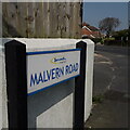
Moordown: Malvern Road
Malvern Road runs west-east from the main Wimborne Road through Moordown to the main Charminster Road through Charminster, which go north-south roughly parallel with each other about a mile apart. Malvern Road takes a very indirect route between the two, with several abrupt corners such as this one here, where Nursery Road emerges. The housing is mixed but mainly early 20th century, such as the house whose end we see in the background.
The sign is a modern one, from 2010-15 when this more modern, abstract emblem rather than the traditional town coat of arms as the working logo of the council.
This is photo no.256 of a series of 453 in my coronavirus lockdown walking project:
See https://www.geograph.org.uk/article/My-2020-Coronavirus-Lockdown-walking-project for the complete set of photos.
Image: © Chris Downer
Taken: 10 Apr 2020
0.01 miles
2
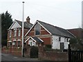
Moordown: International Life Centre
A small chapel-like building, at 5 Nursery Road, which is listed in the 1975 Kelly's Directory as "Malvern Chapel (United Apostolic Faith Chapel)".
Image: © Chris Downer
Taken: 24 Feb 2008
0.03 miles
3
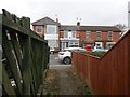
Moordown: footpath M10 comes out opposite the chippy
This very short corner-cutting footpath arrives on Malvern Road from Parley Road, opposite a well-regarded fish and chip shop.
See Image for the view along the path from across the road, and Image for its emergence onto Parley Road at the other end.
Image: © Chris Downer
Taken: 26 Feb 2017
0.04 miles
4
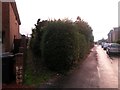
Moordown: footpath M10 to Malvern Road
Looking along the western end of Parley Road, and also along a short public footpath, numbered M10, which comes out on Malvern Road opposite the fish and chip shop.
See Image] for a view towards us from just along the path, and Image for a view from the opposite end.
Image: © Chris Downer
Taken: 22 Jun 2016
0.05 miles
5
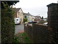
Moordown: footpath M10 comes out on Parley Road
This very short corner-cutting footpath arrives on Parley Road from Malvern Road.
See Image for the view along the path from just ahead, and Image for its emergence onto Malvern Road just behind us.
Image: © Chris Downer
Taken: 26 Feb 2017
0.06 miles
6
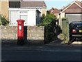
Moordown: postbox № BH9 264 and footpath M10, Malvern Road
This George V-reign postbox stands in Malvern Road alongside this short public footpath to Parley Road. The footpath is not marked on the map because, seemingly, the pink dotted lines denoting a public right of way are never superimposed on the pinkish areas denoting buildings.
See Image] for the view towards us from just along the path, and Image for a view from the other end.
Image: © Chris Downer
Taken: 30 Jun 2008
0.06 miles
7
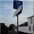
Moordown: Malvern Close
A short side-road off the more major Malvern Road. More than half the length of Malvern Close seems to be passing the side of the corner premises, with the few houses only encircling the very end.
The sign is the standard Bournemouth nameplate from the 1980s, more often seen close to ground level, affixed with tubular steel which protrudes at each side, but here attached high on a lamppost.
This is photo no.255 of a series of 453 in my coronavirus lockdown walking project:
See https://www.geograph.org.uk/article/My-2020-Coronavirus-Lockdown-walking-project for the complete set of photos.
Image: © Chris Downer
Taken: 17 Apr 2020
0.07 miles
8
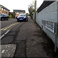
Moordown: Derwent Close
A 1970s cul-de-sac of semi-detached houses off Rose Gardens, which is itself a cul-de-sac.
The sign is the standard Bournemouth nameplate from the 1980s, affixed with tubular steel which protrudes at each side.
This is photo no.108 of a series of 453 in my coronavirus lockdown walking project:
See https://www.geograph.org.uk/article/My-2020-Coronavirus-Lockdown-walking-project for the complete set of photos.
Image: © Chris Downer
Taken: 17 Apr 2020
0.07 miles
9
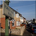
Moordown: Forest View Road
Looking along the top end of Forest View Road, which, behind us, goes steeply downhill and was cut off to through traffic in the 1990s. It might be assumed that the New Forest is the forest referred to in the name, but it could equally be Hurn or somesuch. Now that the area is built up with houses it is difficult to see a forest anyway.
The sign is from around 2000, and it morphed into another design, in blue rather than green and far more widely seen, including BOURNEMOUTH BOROUGH COUNCIL in smaller letters at the top, and the borough coat of arms on the left.
This is photo no.146 of a series of 453 in my coronavirus lockdown walking project:
See https://www.geograph.org.uk/article/My-2020-Coronavirus-Lockdown-walking-project for the complete set of photos.
Image: © Chris Downer
Taken: 12 Apr 2020
0.08 miles
10
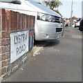
Moordown: Lystra Road
Looking along the pavement of this cul-de-sac of detached houses typical of the whole Moordown area.
The sign is the standard Bournemouth nameplate from the 1980s, usually affixed with tubular steel which protrudes at each side, with a no-through-road sign incorporated into it. I expect this one would originally have been fixed in that way.
This is photo no.251 of a series of 453 in my coronavirus lockdown walking project:
See https://www.geograph.org.uk/article/My-2020-Coronavirus-Lockdown-walking-project for the complete set of photos.
Image: © Chris Downer
Taken: 10 Apr 2020
0.08 miles