
IMAGES TAKEN NEAR TO
The Avenue, BOURNEMOUTH, BH9 2US
Introduction
This page details the photographs taken nearby to The Avenue, BH9 2US by members of the Geograph project.
The Geograph project started in 2005 with the aim of publishing, organising and preserving representative images for every square kilometre of Great Britain, Ireland and the Isle of Man.

There are currently over 7.5m images from over14,400 individuals and you can help contribute to the project by visiting https://www.geograph.org.uk
Image Map
Images are licensed for reuse under creativecommons.org/licenses/by-sa/2.0
Notes
- Clicking on the map will re-center to the selected point.
- The higher the marker number, the further away the image location is from the centre of the postcode.
Image Listing (104 Images Found)
Images are licensed for reuse under creativecommons.org/licenses/by-sa/2.0
Image
Details
Distance
1
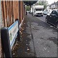
Moordown: Comber Road
One of the several west-east roads in Moordown, crossing between The Grove, The Avenue and Wimborne Road which run north-south. Some of these roads have two segments, but Comber Road is one of the single-segment roads. The houses in the background, desirable detached ones, exemplify the whole area.
The road sign is a standard one from around 2000-2006, perhaps a little earlier, featuring the borough coat of arms.
This is photo no.79 of a series of 453 in my coronavirus lockdown walking project:
See https://www.geograph.org.uk/article/My-2020-Coronavirus-Lockdown-walking-project for the complete set of photos.
Image: © Chris Downer
Taken: 17 Apr 2020
0.02 miles
2
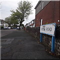
Moordown: Arden Road
One of the west-east roads within the Wimborne Road/The Avenue/The Grove part of Moordown, with middle-class detached houses – and one of the shorter ones with only one rather than two segments.
The sign is of a design that became prevalent in Bournemouth around 1990 and was in use for most of that decade. Many are starting to look a bit shabby now, such as this one with peeling white section and fading blue border.
This is photo no.15 of a series of 451 in my coronavirus lockdown walking project:
See https://www.geograph.org.uk/article/My-2020-Coronavirus-Lockdown-walking-project for the complete set of photos.
Image: © Chris Downer
Taken: 17 Apr 2020
0.03 miles
3
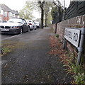
Moordown: Grenfell Road
One of the latticework of roads which sees The Grove, The Avenue and the main Wimborne Road running parallel, with a series of short roads crossing them. Some cover both segments while others, such as Grenfell Road, only make half the journey.
The sign is the standard Bournemouth nameplate from the 1980s, affixed with tubular steel which protrudes at each side.
This is photo no.175 of a series of 453 in my coronavirus lockdown walking project:
See https://www.geograph.org.uk/article/My-2020-Coronavirus-Lockdown-walking-project for the complete set of photos.
Image: © Chris Downer
Taken: 17 Apr 2020
0.04 miles
4
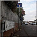
Moordown: Marks Road
One of numerous east-west roads which run from Wimborne Road across The Avenue to The Grove – except that Marks Road is the only one which is a dead end. It runs east from The Avenue, almost but not quite reaching Wimborne Road. It is, however, typical of the area in having decent detached houses form the early 20th century.
The sign is the standard Bournemouth nameplate from the 1980s, affixed with tubular steel which protrudes at each side.
This is photo no.263 of a series of 453 in my coronavirus lockdown walking project:
See https://www.geograph.org.uk/article/My-2020-Coronavirus-Lockdown-walking-project for the complete set of photos.
Image: © Chris Downer
Taken: 17 Apr 2020
0.05 miles
5
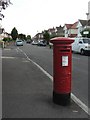
Moordown: postbox № BH9 319, The Grove
A George V-reign postbox in The Grove, close to the Arden Road turning.
Image: © Chris Downer
Taken: 21 Jul 2008
0.06 miles
6
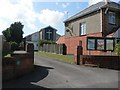
Moordown: Baptist church
Moordown Baptist Church is tucked away behind the houses of The Avenue (here) and The Grove (behind).
Image: © Chris Downer
Taken: 22 Jun 2008
0.07 miles
7
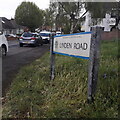
Moordown: Linden Road
A short one-segment road at the northern end of a long area of criss-cross roads on this western side of the main Wimborne Road, forming a series of squares. However, at this northern end, the three main north-south roads – Wimborne Road, The Avenue and The Grove sort of converge on one another, and Linden Road therefore runs in a quirky curve.
The fine detached houses that typify the whole area give way to bungalows on the northern side.
The road sign is a standard one from around 2000-2006, perhaps a little earlier, featuring the borough coat of arms.
This is photo no.244 of a series of 453 in my coronavirus lockdown walking project:
See https://www.geograph.org.uk/article/My-2020-Coronavirus-Lockdown-walking-project for the complete set of photos.
Image: © Chris Downer
Taken: 17 Apr 2020
0.08 miles
8
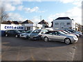
Bournemouth : Moordown - Cars-4-Less
Used car dealership on Wimborne Road.
Image: © Lewis Clarke
Taken: 11 Feb 2010
0.09 miles
9
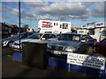
Bournemouth : Moordown - Cars-4-Less & Mike Stokes
Two automobile businesses side by side on Wimborne Road.
Image: © Lewis Clarke
Taken: 11 Feb 2010
0.09 miles
10
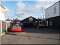
Bournemouth : Moordown - Mike Stokes Motoring Garage
Maybe that is Mike Stokes standing in his own garage - I guess we'll never know.
Image: © Lewis Clarke
Taken: 11 Feb 2010
0.09 miles