1
Moordown: Kingdom Hall of Jehovah?s Witnesses
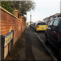
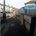
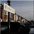
Tucked away in Elmes Road, otherwise a residential back street of Moordown.
Image: © Chris Downer
Taken: 10 Jul 2008
0.04 miles
2
Moordown: Middleton Road
A one-segment road running between the main Redhill Avenue (far end) and Comley Road, comprising desirable detached houses that are typical of hereabouts. The two bungalows visible to the right are probably infill developments in what used to be the longer back garden of the Comley Road corner house.
The road sign is a standard one from around 2000-2006 featuring the borough coat of arms.
This is photo no.270 of a series of 453 in my coronavirus lockdown walking project:
See https://www.geograph.org.uk/article/My-2020-Coronavirus-Lockdown-walking-project for the complete set of photos.
Image: © Chris Downer
Taken: 17 Apr 2020
0.06 miles
3
Redhill: Delhi Road
Looking along this side-road from Redhill Avenue, opposite Redhill Park. It is the northerly of the three 'prongs' forming a fork-shaped layout with Middleton Road the middle one and Elmes Road the southern one, which latter extends eastward to form the fork's handle. Comley Road runs at 90º and links the three roads.
No other roads in the area have an obvious Indian connection in their names, so I don't know how the name Delhi came about.
The houses are typical of the area - fine detached houses built in the earlier decades of the 20th century. The fact that we can only glimpse them tells its own story: the houses were built before off-road parking was a consideration.
The road sign is a standard one from around 2000-2006, perhaps a little earlier, featuring the borough coat of arms.
This is photo no.107 of a series of 453 in my coronavirus lockdown walking project:
See https://www.geograph.org.uk/article/My-2020-Coronavirus-Lockdown-walking-project for the complete set of photos.
Image: © Chris Downer
Taken: 17 Apr 2020
0.06 miles
4
Redhill: playing field
The vast playing field of Redhill Park, from the southern corner. The signpost points towards
Image
See also
Image
Image: © Chris Downer
Taken: 8 Jun 2008
0.07 miles
5
Moordown: postbox № BH9 247, Comley Road
This George V-reign postbox is by the corner of Comley and Middleton Roads.
Image: © Chris Downer
Taken: 10 Jul 2008
0.08 miles
6
Moordown: Elmes Road
Looking along this long road of typical-for-Moordown early-20th-century detached houses, from its one junction, midway along, with Comley Road. Elmes Road does a slight kink at this junction, but not in the direction indicated by the curve of the pavement: immediately next to us, it swings back the other way and carries on a few degrees the other side of straight.
The road sign is a standard one from around 2000-2006, perhaps a little earlier, featuring the borough coat of arms. It is one of the earliest of these examples, with slightly broader typeface and with the name on a single line.
This is photo no.128 of a series of 453 in my coronavirus lockdown walking project:
See https://www.geograph.org.uk/article/My-2020-Coronavirus-Lockdown-walking-project for the complete set of photos.
Image: © Chris Downer
Taken: 17 Apr 2020
0.08 miles
7
Redhill Park: bowling and tennis
The bowling green and tennis courts at this popular council-run park.
Image: © Chris Downer
Taken: 8 Jun 2008
0.08 miles
8
Redhill: new hard football pitch and landscaping
A wider view of
Image, showing the new landscaping with young trees separating it from the main sports field.
Image: © Chris Downer
Taken: 23 Oct 2010
0.09 miles
9
Moordown: Comley Road
This street of detached houses comes towards us from Elmes Road and comes to an end, with Delhi Road at 90º to our right.
The road sign is a standard one from around 2000-2006, perhaps a little earlier, featuring the borough coat of arms, but is an unframed version set high on a lamp post rather than the usual position on two posts.
This is photo no.80 of a series of 453 in my coronavirus lockdown walking project:
See https://www.geograph.org.uk/article/My-2020-Coronavirus-Lockdown-walking-project for the complete set of photos.
Image: © Chris Downer
Taken: 17 Apr 2020
0.09 miles
10
Redhill: hard football pitch in Redhill Park
During the early part of 2010, this hard-court pitch with inbuilt basketball rings and football goals was installed in a corner of the large sports field of Redhill Park. Some landscaping has also been done - see
Image for a wider view.
Image: © Chris Downer
Taken: 23 Oct 2010
0.09 miles


