
IMAGES TAKEN NEAR TO
Talbot Road, BOURNEMOUTH, BH9 2JF
Introduction
This page details the photographs taken nearby to Talbot Road, BH9 2JF by members of the Geograph project.
The Geograph project started in 2005 with the aim of publishing, organising and preserving representative images for every square kilometre of Great Britain, Ireland and the Isle of Man.

There are currently over 7.5m images from over14,400 individuals and you can help contribute to the project by visiting https://www.geograph.org.uk
Image Map
Images are licensed for reuse under creativecommons.org/licenses/by-sa/2.0
Notes
- Clicking on the map will re-center to the selected point.
- The higher the marker number, the further away the image location is from the centre of the postcode.
Image Listing (102 Images Found)
Images are licensed for reuse under creativecommons.org/licenses/by-sa/2.0
Image
Details
Distance
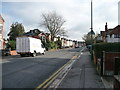
2
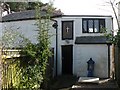
Winton: British Orthodox Church of Christ the Saviour
This tiny church, hemmed in between the gardens of houses in Osborne and Woodend Roads, appears to have escaped the attention of the OS map compilers of all but the largest of scales, and escapes appearing on any local street plan. In fact, I knew nothing of its existence until two days ago when I was looking at Kelly's 1975 directory for another reason altogether; I have lived nearby for 20 years and my mother, who moved to Winton in the late 1950s, didn't know it was there either!
The British Orthodox Church has about a dozen churches in England, and this is one of them. More information is on their website here: http://www.britishorthodox.org/bournemouth.php
It is accessed via a gateway in Osborne Road: see Image
For a view showing the complete building, see Image
Image: © Chris Downer
Taken: 2 Mar 2008
0.05 miles
3
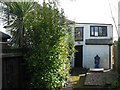
Winton: approaching the Church of Christ the Saviour
Looking along the path to the Image, showing the complete building behind the greenery. It is almost certainly the most secluded of Bournemouth's many churches, and has a good claim for the town's smallest. It is overlooked by the local street plans and OS maps on all but the very largest scales.
Image: © Chris Downer
Taken: 2 Mar 2008
0.05 miles
4
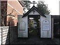
Winton: Orthodox Church gateway
The entranceway to the Image, on Osborne Road.
Image: © Chris Downer
Taken: 2 Mar 2008
0.05 miles
5
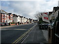
Bournemouth : Talbot Road
A Bournemouth University letting sign and Talbot Road in Winton.
Image: © Lewis Clarke
Taken: 13 Feb 2009
0.06 miles
6

Winton: postbox № BH9 77, Talbot Road
This Elizabeth II-reign box stands alongside a bus stop on Talbot Road, part of the busy A3049 across the northern suburbs of Bournemouth.
Image: © Chris Downer
Taken: 10 Jul 2008
0.06 miles
7
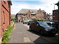
Winton: Bryanstone Walk arrives at Talbot Road
This lane is a rear access driveway for shops and flats in Wimborne Road, and is also public footpath A16. We look at its northern end, emerging onto Talbot Road by the main Winton Banks junction. The junction is so called because of the banks on the corner - the former Lloyds Bank across the road, and the NatWest, which still operates here, across whose car park we are looking diagonally.
Image: © Chris Downer
Taken: 28 Jun 2016
0.10 miles
8
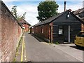
Winton: footpath A16 passes Michael Grubb Studio
A picture a little way along from Image], showing this public footpath as it passes what was presumably originally a garage or outbuilding of one of the shops (or flats above) in Wimborne Road. Michael Grubb Studio is a crative lighting company and it is one of the very few postal addresses in Bryanstone Walk.
See Image for a view towards us from just beyond the bend ahead.
Image: © Chris Downer
Taken: 28 Jun 2016
0.10 miles
9
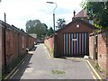
Winton: stripy garage in Bryanstone Walk
Looking along Bryanstone Walk, public footpath A16, towards Bryanstone Road.
See Image] for a view towards us from just ahead, and Image for the view behind us onto Talbot Road.
Image: © Chris Downer
Taken: 28 Jun 2016
0.10 miles
10
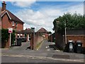
Winton: Bryanstone Walk from Bryanstone Road
The driveway ahead is essentially a rear access for shops in Wimborne Road. It also forms public footpath A16. See Image for the next picture along the path.
Image: © Chris Downer
Taken: 28 Jun 2016
0.10 miles