
IMAGES TAKEN NEAR TO
Melgate Close, BOURNEMOUTH, BH9 2EE
Introduction
This page details the photographs taken nearby to Melgate Close, BH9 2EE by members of the Geograph project.
The Geograph project started in 2005 with the aim of publishing, organising and preserving representative images for every square kilometre of Great Britain, Ireland and the Isle of Man.

There are currently over 7.5m images from over14,400 individuals and you can help contribute to the project by visiting https://www.geograph.org.uk
Image Map
Images are licensed for reuse under creativecommons.org/licenses/by-sa/2.0
Notes
- Clicking on the map will re-center to the selected point.
- The higher the marker number, the further away the image location is from the centre of the postcode.
Image Listing (162 Images Found)
Images are licensed for reuse under creativecommons.org/licenses/by-sa/2.0
Image
Details
Distance
1
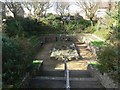
Winton: sunken garden
This small garden is alongside Image The holes in the stonework bring to mind former beams, such as in castle ruins, but I can find no record of a building whose foundations form the basis of the garden.
Image: © Chris Downer
Taken: 1 Mar 2008
0.01 miles
2
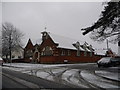
Winton: the library in snow
Another view of Image, in unusual (for round here) weather conditions.
This burst of snowfall was surprising, since it had started rainy this morning. This picture was taken at lunchtime, by which time the snowfall had been going on for a couple of hours. By nightfall, the main carriageways of all the roads were clear of snow and ice, making this the severest snowfall I think I have ever seen that had started and almost disappeared all on the same day.
Throughout the day, the BBC weather forecast suggested temperatures of about 2ºC and 'light rain'.
Image: © Chris Downer
Taken: 6 Feb 2009
0.01 miles
3
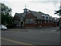
Winton Library
At junction Wimborne & Library Roads, English Heritage-listed http://www.imagesofengland.org.uk/Details/Default.aspx?id=101907&mode=adv. Looks as if it was designed by the same architect as Image; opened 1907. http://www.wintonforum.co.uk/library.html
Image: © Mike Faherty
Taken: 26 May 2009
0.02 miles
4
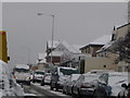
Winton: a view from a queue
Stuck in traffic on the main Wimborne Road – owing to the weather and the fact that large vehicles were having to make their way down Image rather gingerly – I stuck the camera out of the window and took this picture.
Image: © Chris Downer
Taken: 6 Feb 2009
0.02 miles
5
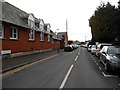
Bournemouth : Library Road
Library Road in Winton.
Image: © Lewis Clarke
Taken: 25 Mar 2018
0.02 miles
6
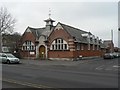
Winton: library
Bournemouth's first purpose-built library was built in 1907. It is in Wimborne Road, on the corner of Library Road. The entrance today is round the left-hand side, accommodating a ramp.
The history of the building can be found here: http://www.wintonforum.co.uk/library.html
Image: © Chris Downer
Taken: 24 Feb 2008
0.02 miles
7
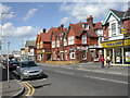
Winton, The Talbot
On Wimborne Road; note the attractive half-tiled facade. Internally, L-shaped bar, drinking areas on three sides; pool & darts. Cask ale on offer at my visit: Ringwood Best. For some customer reviews, see http://www.beerintheevening.com/pubs/comments.shtml/2328/
Image: © Mike Faherty
Taken: 26 May 2009
0.02 miles
8
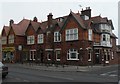
Winton: The Talbot
At 559-561 Wimborne Road, on the corner of Pine Road.
Image: © Chris Downer
Taken: 24 Feb 2008
0.04 miles
9
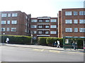
Bournemouth : Winton, Talbot Court
Talbot Court is a residential building on Wimborne Road. There is a bus stop just outside as we can see here.
Image: © Lewis Clarke
Taken: 20 Mar 2009
0.04 miles
10
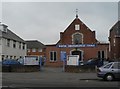
Winton: Christadelphian Church
Situated on Wimborne Road, the main road through Winton, between numbers 572 and 580.
Image: © Chris Downer
Taken: 24 Feb 2008
0.05 miles